|
|
Weather Alert |
| Montgomery County, NC | |||||||||
|
|
||||||||
|
Canceled 3/21/26 10:15 PM Special Weather Statement issued March 21 at 9:29PM EDT by NWS Raleigh NC At 928 PM EDT, Doppler radar was tracking a cluster of strong thunderstorms along a line extending from near Thomasville to Badin Lake to 10 miles southeast of Midland. Movement was southeast at 55 mph. HAZARD...Wind gusts in excess of 30 mph. SOURCE...Radar indicated. IMPACT...Gusty winds could knock down tree limbs and blow around unsecured objects. Locations impacted include... High Point, Asheboro, Lexington, Laurinburg, Albemarle, Southern Pines, Rockingham, Wadesboro, Randleman, and Troy. This includes the following highways... Interstate 85 between Mile Markers 92 and 111. Interstate 73 between Mile Markers 26 and 84. Interstate 74 between Mile Markers 78 and 79. 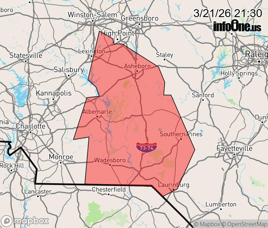 |
|||||||||
 Why aren't you using the InfoOne app? Why aren't you using the InfoOne app?
Stay abreast of information affecting your community! InfoOne tracks real-time information such as:
InfoOne currently supports over 100 communities in NC, VA and WV, and our coverage area is steadily growing. It's free! Install the InfoOne app today and see what you've been missing. |
|||||||||