|
|
Weather Alert |
| Surry County, NC | |||||||||
|
|
||||||||
|
Canceled 6/27/22 12:45 PM Special Weather Statement issued June 27 at 12:20PM EDT by NWS Blacksburg VA At 1219 PM EDT, Doppler radar was tracking strong thunderstorms along a line extending from Collinstown to Crutchfield. Movement was southeast at 20 mph. HAZARD...Winds in excess of 30 mph. SOURCE...Radar indicated. IMPACT...Gusty winds could knock down tree limbs and blow around unsecured objects. Torrential rainfall is also occurring with these storms and may lead to localized flooding. Do not drive your vehicle through flooded roadways. Locations impacted include... Elkin... Fairview... Yadkinville... Pilot Mountain... Boonville... East Bend... and Danbury. 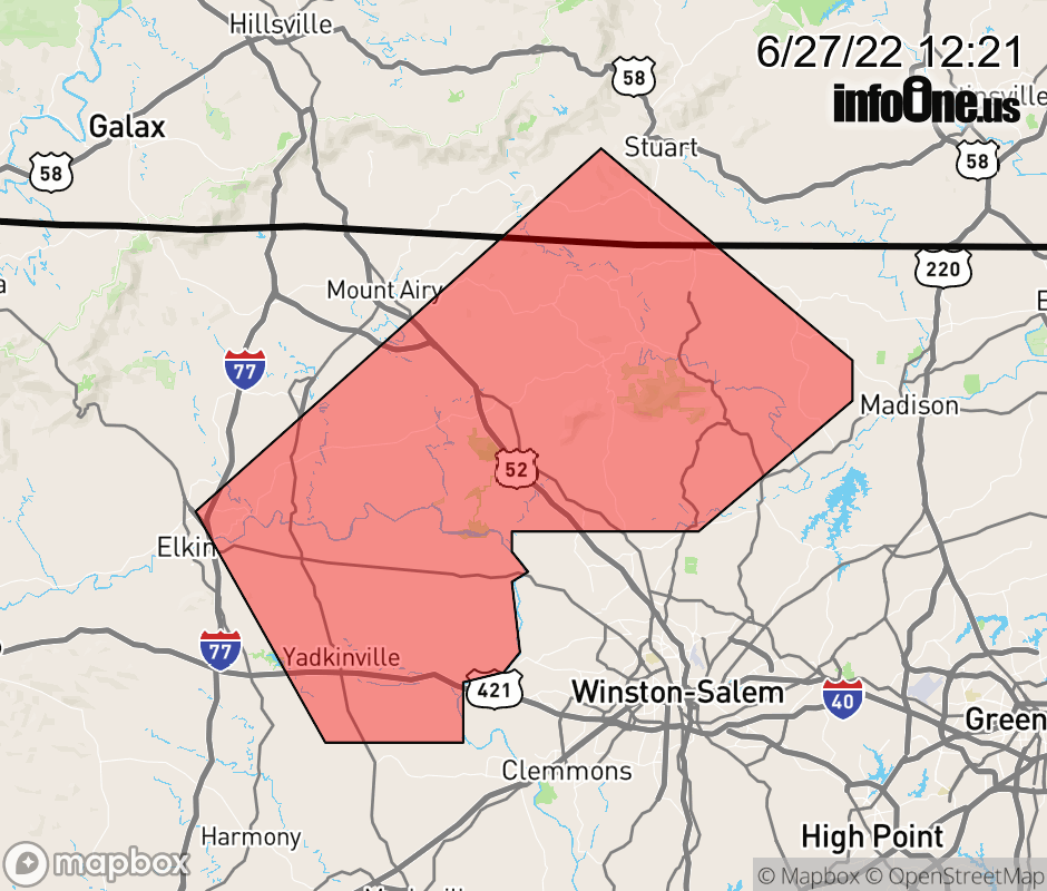 |
|||||||||
 Why aren't you using the InfoOne app? Why aren't you using the InfoOne app?
Stay abreast of information affecting your community! InfoOne tracks real-time information such as:
InfoOne currently supports over 100 communities in NC, VA and WV, and our coverage area is steadily growing. It's free! Install the InfoOne app today and see what you've been missing. |
|||||||||