|
|
Weather Alert |
| Meigs County, OH | |||||||||
|
|
||||||||
|
Canceled 7/5/26 3:41 PM Severe Thunderstorm Warning issued July 5 at 3:28PM EDT until July 5 at 4:00PM EDT by NWS Charleston WV SVRRLX The National Weather Service in Charleston West Virginia has issued a * Severe Thunderstorm Warning for... Southeastern Meigs County in southeastern Ohio... North central Mason County in western West Virginia... West central Wirt County in northwestern West Virginia... Northern Jackson County in northwestern West Virginia... Southwestern Wood County in northwestern West Virginia... * Until 400 PM EDT. * At 328 PM EDT, severe thunderstorms were located along a line extending from near Lubeck to near Forked Run State Park to 6 miles southwest of Racine, moving east at 15 mph. HAZARD...60 mph wind gusts and quarter size hail. SOURCE...Radar indicated. IMPACT...Hail damage to vehicles is expected. Expect wind damage to roofs, siding, and trees. * Locations impacted include... Racine, Forked Run State Park, Ravenswood, Mineralwells, Cottageville, Portland, Mount Alto, Belleville, Reedsville, Rockport, and Letart. This includes Interstate 77 in West Virginia between mile markers 142 and 170. 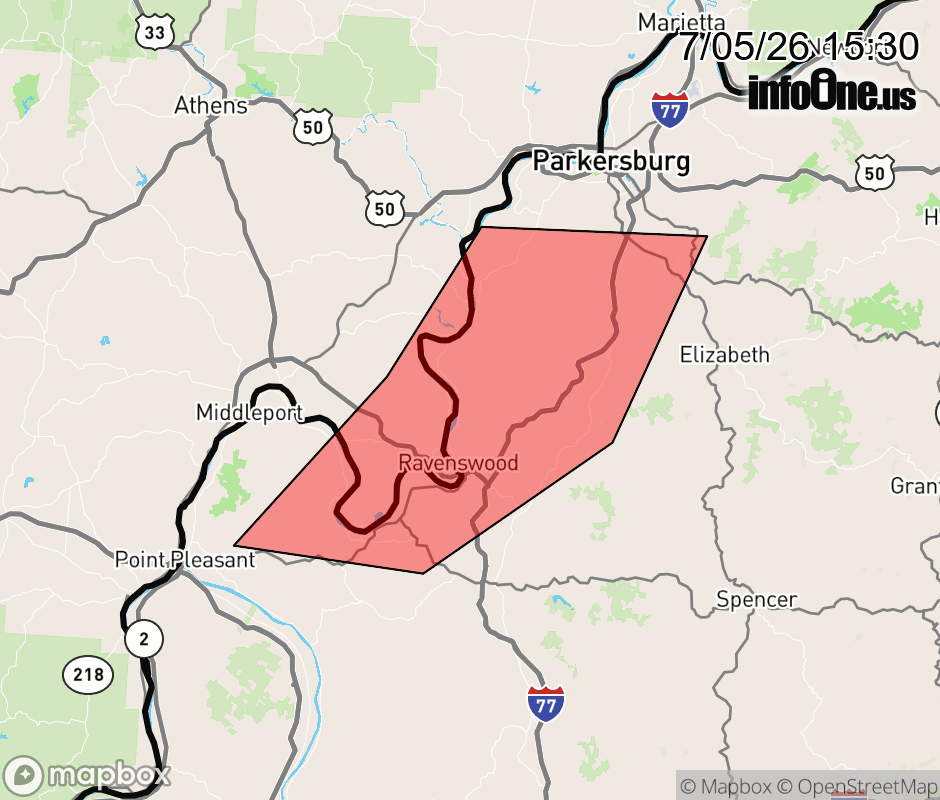 |
|||||||||
 Why aren't you using the InfoOne app? Why aren't you using the InfoOne app?
Stay abreast of information affecting your community! InfoOne tracks real-time information such as:
InfoOne currently supports over 100 communities in NC, VA and WV, and our coverage area is steadily growing. It's free! Install the InfoOne app today and see what you've been missing. |
|||||||||