|
|
Weather Alert |
| Calhoun County, WV | |||||||||
|
|
||||||||
|
Canceled 7/4/26 2:15 PM Special Weather Statement issued July 4 at 1:48PM EDT by NWS Charleston WV At 148 PM EDT, Doppler radar was tracking strong thunderstorms along a line extending from Wallback to 6 miles north of Twin Falls State Park. Movement was east at 25 mph. HAZARD...Wind gusts up to 50 mph and pea size hail. SOURCE...Radar indicated. IMPACT...Gusty winds could knock down tree limbs and blow around unsecured objects. Minor hail damage to vegetation is possible. Locations impacted include... Beckley, Fayetteville, Clay, Oak Hill, Montgomery, Mount Hope, Mabscott, Ansted, Oceana, Sophia, Gassaway, Smithers, Gauley Bridge, Pratt, Piney View, Coal City, Prosperity, Burnwell, Crab Orchard, and Dry Creek. This includes the following highways... Interstate 79 between mile markers 26 and 55. West Virginia Turnpike between mile markers 36 and 77. Interstate 64 in West Virginia between mile markers 120 and 125. Route 19 between mile markers 1 and 27. 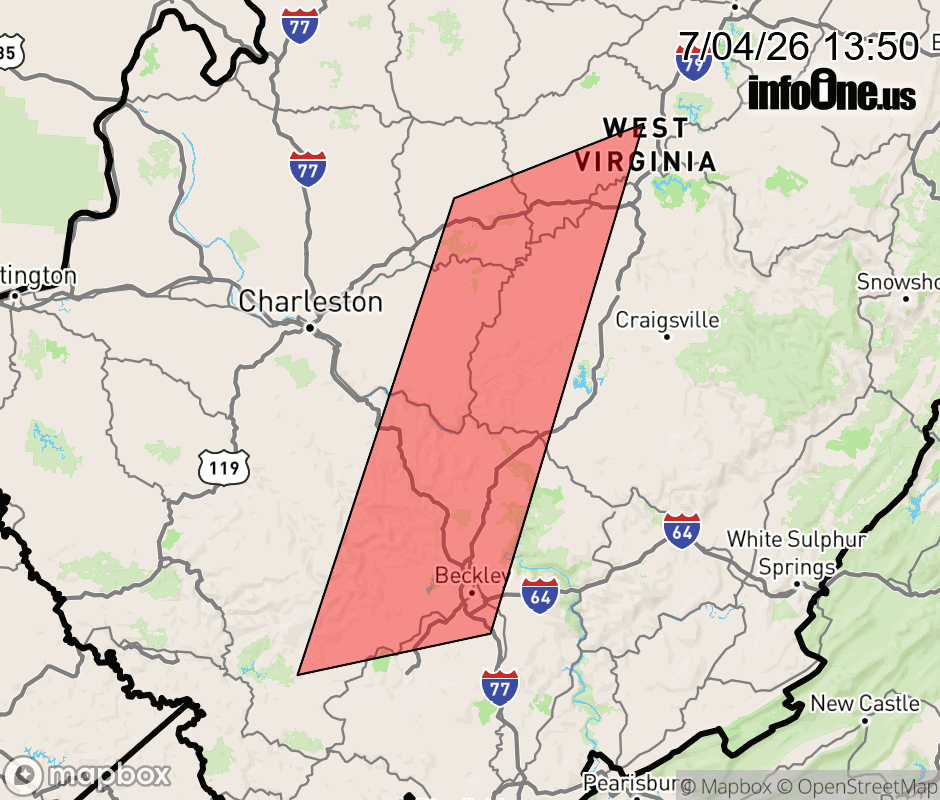 |
|||||||||
 Why aren't you using the InfoOne app? Why aren't you using the InfoOne app?
Stay abreast of information affecting your community! InfoOne tracks real-time information such as:
InfoOne currently supports over 100 communities in NC, VA and WV, and our coverage area is steadily growing. It's free! Install the InfoOne app today and see what you've been missing. |
|||||||||