|
|
Weather Alert |
| Tazewell County, VA | |||||||||
|
|
||||||||
|
Canceled 8/10/22 9:30 PM Flood Warning issued August 10 at 6:39PM EDT until August 10 at 9:30PM EDT by NWS Blacksburg VA * WHAT... Flooding caused by excessive rainfall is expected. * WHERE... A portion of southwest Virginia, including the following counties, Grayson, Smyth, Tazewell and Wythe. * WHEN... Until 930 PM EDT. * IMPACTS... Flooding of rivers, creeks, streams, and other low-lying and flood-prone locations is imminent or occurring. Low-water crossings are inundated with water and may not be passable. * ADDITIONAL DETAILS... - At 636 PM EDT, Doppler radar indicated heavy rain due to thunderstorms. Flooding has been reported by the Emergency Manager in the Chilhowie area along Whitetop Road, Marion area along Route 16, and Saltville area. Between 1 and 2 inches of rain have fallen. - This includes the following streams and drainages... Campbell Creek, Crewey Branch, Dry Run, Dulton Branch, East Dry Run Fork, Dry Creek, Comers Rock Branch, Cripple Creek, Beaver Creek, Deans Branch, Blue Spring Creek, Comers Creek and Dickey Creek. Additional rainfall amounts of 0.5 to 1 inch are possible in the warned area. - Some locations that will experience flooding include... Marion, Saltville, Chilhowie, Rural Retreat, Mount Rogers National Recreation Area, Sugar Grove and Troutdale. - http://www.weather.gov/safety/flood 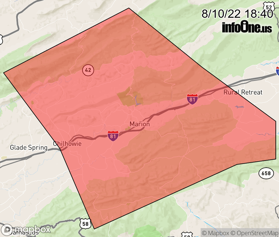 |
|||||||||
 Why aren't you using the InfoOne app? Why aren't you using the InfoOne app?
Stay abreast of information affecting your community! InfoOne tracks real-time information such as:
InfoOne currently supports over 100 communities in NC, VA and WV, and our coverage area is steadily growing. It's free! Install the InfoOne app today and see what you've been missing. |
|||||||||