|
|
Weather Alert |
| Summit County, OH | |||||||||
|
|
||||||||
|
Canceled 4/22/26 9:15 PM Special Weather Statement issued April 22 at 8:36PM EDT by NWS Cleveland OH At 836 PM EDT, Doppler radar was tracking strong thunderstorms along a line extending from near Barberton to 7 miles northwest of Massillon to near Dalton. Movement was southeast at 30 mph. HAZARD...Wind gusts up to 40 mph and half inch hail. SOURCE...Radar indicated. IMPACT...Gusty winds could knock down tree limbs and blow around unsecured objects. Minor hail damage to vegetation is possible. Locations impacted include... Canton, Massillon, Green, North Canton, Louisville, Navarre, Dalton, New Franklin, Canal Fulton, East Canton, Clinton, Meyers Lake, Hills And Dales, Greentown, Perry Heights, North Lawrence, and Portage Lakes. 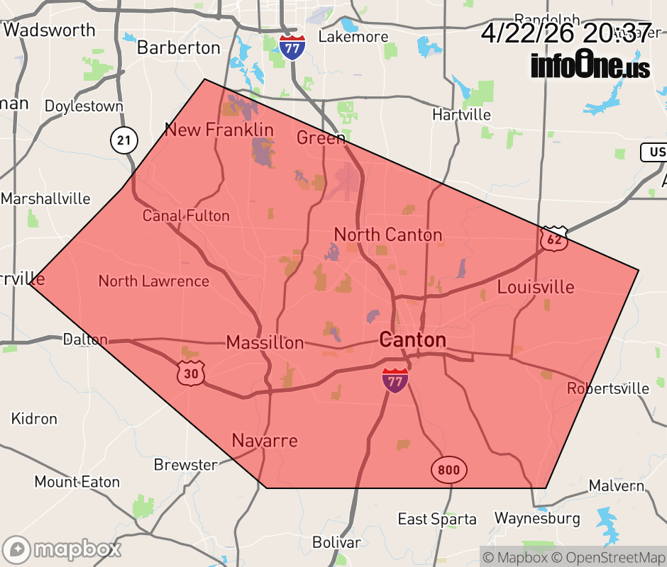 |
|||||||||
 Why aren't you using the InfoOne app? Why aren't you using the InfoOne app?
Stay abreast of information affecting your community! InfoOne tracks real-time information such as:
InfoOne currently supports over 100 communities in NC, VA and WV, and our coverage area is steadily growing. It's free! Install the InfoOne app today and see what you've been missing. |
|||||||||