|
|
Weather Alert |
| Portage County, OH | |||||||||
|
|
||||||||
|
Canceled 10/21/21 5:45 PM Tornado Warning issued October 21 at 5:04PM EDT until October 21 at 5:45PM EDT by NWS Cleveland OH The National Weather Service in Cleveland has issued a * Tornado Warning for... Northern Portage County in northeastern Ohio... Southeastern Geauga County in northeastern Ohio... Northeastern Summit County in northeastern Ohio... * Until 545 PM EDT. * At 504 PM EDT, a severe thunderstorm capable of producing a tornado was located over Hudson, or 12 miles north of Akron, moving east at 35 mph. HAZARD...Tornado. SOURCE...Radar indicated rotation. IMPACT...Flying debris will be dangerous to those caught without shelter. Mobile homes will be damaged or destroyed. Damage to roofs, windows, and vehicles will occur. Tree damage is likely. * This dangerous storm will be near... Kent around 510 PM EDT. Streetsboro around 520 PM EDT. Mantua around 525 PM EDT. Garrettsville around 545 PM EDT. Other locations impacted by this tornadic thunderstorm include Parkman, Aurora, Brady Lake, Peninsula, Windham, Sugar Bush Knolls, Wayland, Hiram, Reminderville, Boston Heights, Stow and Silver Lake. 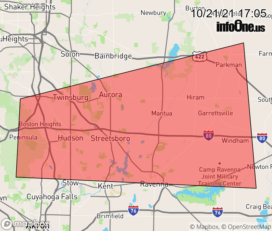 |
|||||||||
 Why aren't you using the InfoOne app? Why aren't you using the InfoOne app?
Stay abreast of information affecting your community! InfoOne tracks real-time information such as:
InfoOne currently supports over 100 communities in NC, VA and WV, and our coverage area is steadily growing. It's free! Install the InfoOne app today and see what you've been missing. |
|||||||||