
|
Weather Alert |
| Washington County, OH | |||||||||
|
|
||||||||
|
Canceled 8/11/26 6:02 PM Flash Flood Warning issued August 11 at 3:03PM EDT until August 11 at 6:15PM EDT by NWS Charleston WV FFWRLX The National Weather Service in Charleston has extended the * Flash Flood Warning for... North Central Athens County in southeastern Ohio... Morgan County in southeastern Ohio... Southern Perry County in southeastern Ohio... Northwestern Washington County in southeastern Ohio... * Until 615 PM EDT. * At 303 PM EDT, Even though heavy rainfall has ended for now, continued runoff will result in flash flooding of creeks and streams. Additionally, thunderstorms may move back into the area late this afternoon, further exacerbating the flooding situation. HAZARD...Flash flooding caused by thunderstorms. SOURCE...Radar and automated gauges. IMPACT...Between 3 and 5 inches of rain fell from overnight thunderstorms which resulted in flooding of some structures, vehicles, and roads. This area is particularly vulnerable to additional heavy rainfall. People should remain vigilant into the early evening hours for additional rises of creeks and streams. * Some locations that will experience flash flooding include... Glouster, McConnelsville, Malta, Corning, Trimble, Burr Oak State Park and Hackney. Sunday Creek at Glouster was in minor flood with a stage of 15.5 feet and slowly rising. At this stage, West Main Street and a portion of Center Street flood in Glouster. In Jacksonville, Palmer Street near the creek floods. 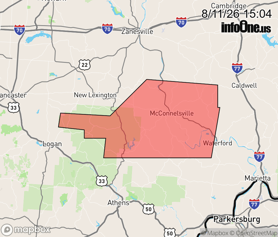 |
|||||||||
 Why aren't you using the InfoOne app? Why aren't you using the InfoOne app?
Stay abreast of information affecting your community! InfoOne tracks real-time information such as:
InfoOne currently supports over 100 communities in NC, VA and WV, and our coverage area is steadily growing. It's free! Install the InfoOne app today and see what you've been missing. |
|||||||||