|
|
Weather Alert |
| Montgomery County, NC | |||||||||
|
|
||||||||
|
Canceled 12/19/25 6:30 AM Severe Thunderstorm Warning issued December 19 at 5:54AM EST until December 19 at 6:30AM EST by NWS Raleigh NC At 553 AM EST, severe thunderstorms were located along a line extending from near Graham to near Seagrove to near Troy, moving east at 45 mph. HAZARD...60 mph wind gusts. SOURCE...Radar indicated. IMPACT...Expect damage to roofs, siding, and trees. Locations impacted include... Chapel Hill, Burlington, Graham, Hillsborough, Troy, Siler City, North Carolina Zoo, Carrboro, Mebane, and Biscoe. This includes the following highways... Interstate 85 between Mile Markers 163 and 170. Interstate 40 between Mile Markers 144 and 155, between Mile Markers 160 and 162, and between Mile Markers 259 and 266. Interstate 73 between Mile Markers 42 and 65. 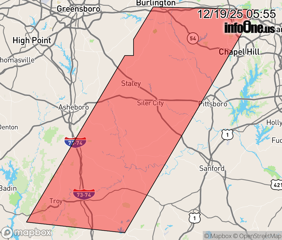 |
|||||||||
 Why aren't you using the InfoOne app? Why aren't you using the InfoOne app?
Stay abreast of information affecting your community! InfoOne tracks real-time information such as:
InfoOne currently supports over 100 communities in NC, VA and WV, and our coverage area is steadily growing. It's free! Install the InfoOne app today and see what you've been missing. |
|||||||||