|
|
Weather Alert |
| Union County, NC | |||||||||
|
|
||||||||
|
Canceled 6/25/25 8:45 PM Special Weather Statement issued June 25 at 8:07PM EDT by NWS Greenville-Spartanburg SC At 807 PM EDT, Doppler radar was tracking a cluster of strong thunderstorms 10 miles east of Uptown Charlotte, or over Mint Hill, moving southwest at 15 mph. HAZARD...Wind gusts up to 40 mph and pea size hail. SOURCE...Radar indicated. IMPACT...Gusty winds could knock down tree limbs and blow around unsecured objects. Minor hail damage to outdoor objects is possible. Locations impacted include... Monroe, South Charlotte, East Charlotte, Matthews, Mint Hill, Indian Trail, Weddington, Stallings, Wesley Chapel, and Lake Park. 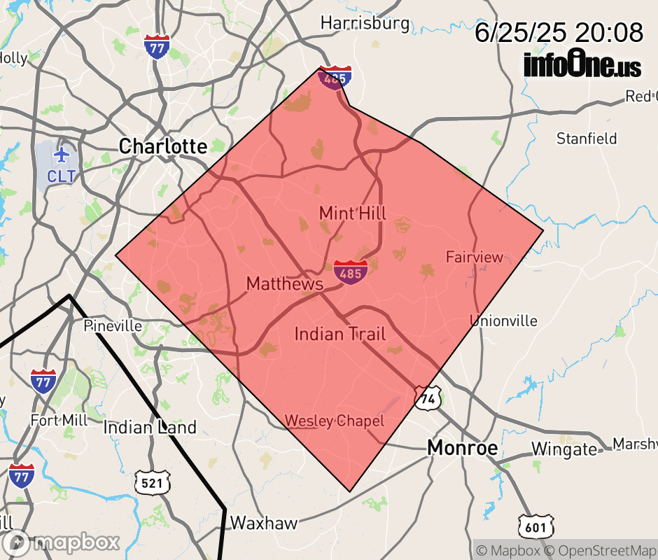 |
|||||||||
 Why aren't you using the InfoOne app? Why aren't you using the InfoOne app?
Stay abreast of information affecting your community! InfoOne tracks real-time information such as:
InfoOne currently supports over 100 communities in NC, VA and WV, and our coverage area is steadily growing. It's free! Install the InfoOne app today and see what you've been missing. |
|||||||||