
|
Weather Alert |
| Washington County, OH | |||||||||
|
|
||||||||
|
Canceled 7/22/26 1:35 AM Flood Warning issued July 21 at 8:09PM EDT until July 22 at 2:00AM EDT by NWS Charleston WV * WHAT... Flooding caused by excessive rainfall is expected. * WHERE... Northeastern Washington County in southeastern Ohio... Northwestern Doddridge County in northern West Virginia... Tyler County in northern West Virginia... Northeastern Pleasants County in northwestern West Virginia... Northeastern Ritchie County in northwestern West Virginia... * WHEN... Until 200 AM EDT. * IMPACTS... Flooding of rivers, creeks, streams, and other low-lying and flood-prone locations is imminent or occurring. It will take several hours for all the water from these storms to work through local drainage systems in urban areas. * ADDITIONAL DETAILS... - At 806 PM EDT, Doppler radar indicated heavy rain due to thunderstorms. Flooding is ongoing or expected to begin shortly in the warned area. Between 2 and 3 inches of rain have fallen. Continued runoff will lead to strong rises on the larger creeks in the area this evening. This includes Duck Creek which is cresting in minor flood stage at Macksburg. - Some locations that will experience flooding include... St. Marys, Middlebourne, Paden City, Sistersville, Matamoras, Lowell, Macksburg, Friendly, Lower Salem, New Matamoras, Point Lookout, Arvilla, Wick, Mountain, Alma, Lima and Devola. - This includes Interstate 77 in Ohio between mile markers 6 and 17. - http://www.weather.gov/safety/flood 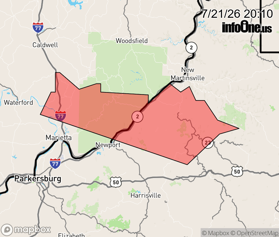 |
|||||||||
 Why aren't you using the InfoOne app? Why aren't you using the InfoOne app?
Stay abreast of information affecting your community! InfoOne tracks real-time information such as:
InfoOne currently supports over 100 communities in NC, VA and WV, and our coverage area is steadily growing. It's free! Install the InfoOne app today and see what you've been missing. |
|||||||||