
|
Weather Alert |
| El Paso County, CO | |||||||||
|
|
||||||||
|
Canceled 8/17/26 3:45 AM Flash Flood Warning issued August 17 at 1:26AM MDT until August 17 at 3:45AM MDT by NWS Pueblo CO At 126 AM MDT, Doppler radar indicated thunderstorms producing heavy rain over the 24 Burn Scar. Between 1 and 3.5 inches of rain have fallen. Additional rainfall amounts of 0.3 to 0.5 inches are possible in the warned area. Flash flooding is ongoing or expected to begin shortly. Excessive rainfall over the burn scar will result in debris flow. The debris flow can consist of rock, mud, vegetation and other loose materials. HAZARD...Life threatening flash flooding. Thunderstorms producing flash flooding in and around the 24 Burn Scar. SOURCE...Radar indicated. IMPACT...Life threatening flash flooding of areas in and around the 24 Burn Scar. Some locations that will experience flash flooding include... Locations along Highway 115 in rural areas of East Central Fremont, Southwestern El Paso and Northwestern Pueblo Counties. 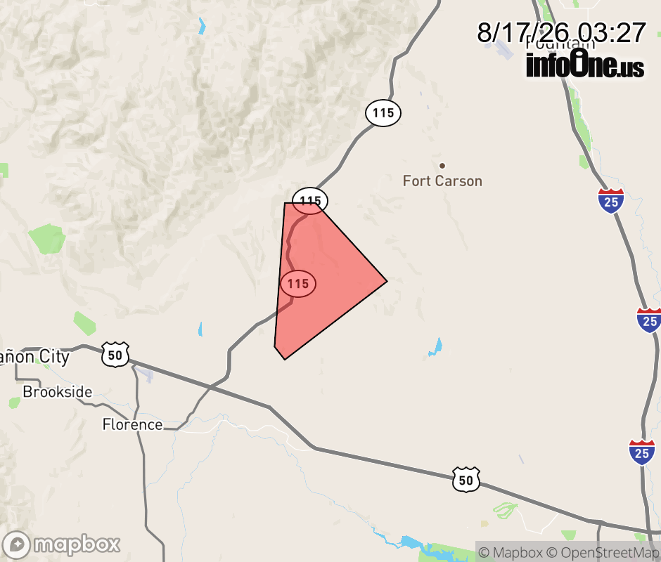 |
|||||||||
 Why aren't you using the InfoOne app? Why aren't you using the InfoOne app?
Stay abreast of information affecting your community! InfoOne tracks real-time information such as:
InfoOne currently supports over 100 communities in NC, VA and WV, and our coverage area is steadily growing. It's free! Install the InfoOne app today and see what you've been missing. |
|||||||||