|
|
Weather Alert |
| Lewis County, WV | |||||||||
|
|
||||||||
|
Canceled 10/21/21 9:15 PM Special Weather Statement issued October 21 at 8:31PM EDT by NWS Charleston WV At 830 PM EDT, Doppler radar was tracking a strong thunderstorm 9 miles southeast of West Union, or 14 miles northwest of Weston, moving east at 35 mph. HAZARD...Winds in excess of 40 mph. SOURCE...Radar indicated. IMPACT...Gusty winds could knock down tree limbs and blow around unsecured objects. Locations impacted include... Clarksburg, Bridgeport, Stonewood, Nutter Fort, Anmoore, West Milford, Lost Creek, Jane Lew, Wolf Summit and Despard. This includes the following highways... Interstate 79 between mile markers 106 and 124. Route 50 in West Virginia between mile markers 71 and 82. 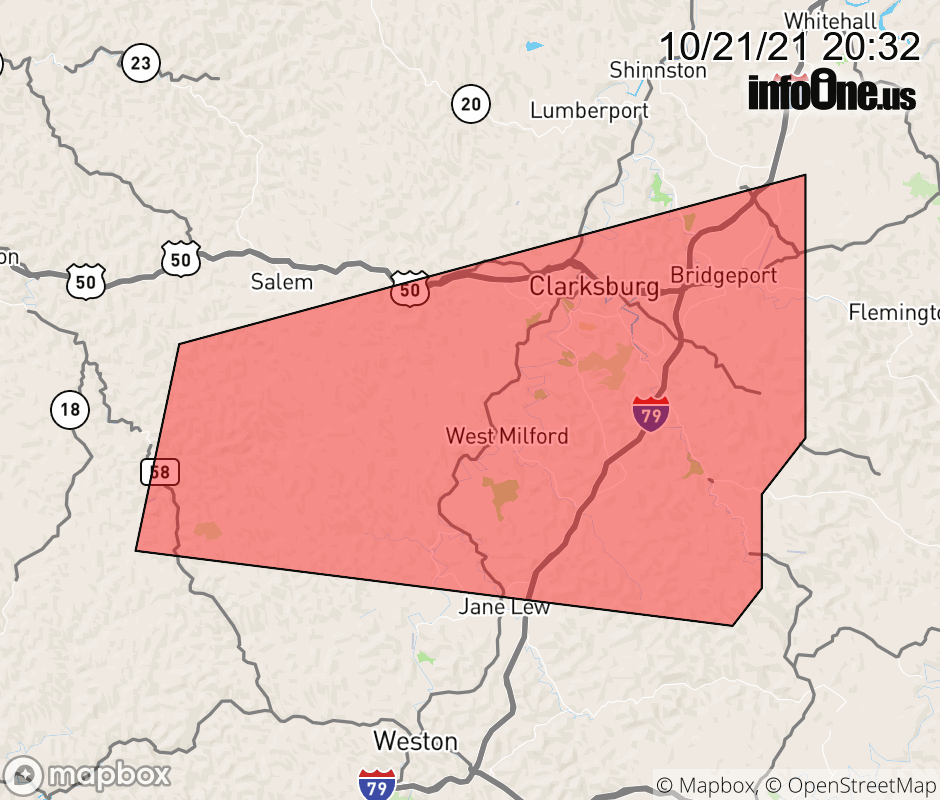 |
|||||||||
 Why aren't you using the InfoOne app? Why aren't you using the InfoOne app?
Stay abreast of information affecting your community! InfoOne tracks real-time information such as:
InfoOne currently supports over 100 communities in NC, VA and WV, and our coverage area is steadily growing. It's free! Install the InfoOne app today and see what you've been missing. |
|||||||||