|
|
Weather Alert |
| Grant County, WV | |||||||||
|
|
||||||||
|
Canceled 1/11/26 12:00 PM Special Weather Statement issued January 11 at 7:31AM EST by NWS Baltimore MD/Washington DC A reinforcing shot of cold air moving in this morning will help to generate a line of heavier snow showers and possibly some embedded, dangerous snow squalls. Visibility restrictions to a half-mile or less, a quick coating of snow on roadways, and brief wind gusts of 35 to 45 mph are expected to accompany many of these heavier snow showers. Depending on exact air and road surface temperatures, flash freeze conditions might develop (a quick transition from wet to icy road surfaces). A line of heavier snow showers and possible snow squalls is expected to affect the following locations at approximately the reference times: * Oakland, Keyser's Ridge, Deep Creek Lake, and Frostburg from about 9 to 10 am * Keyser, Cumberland, and Petersburg from about 10 to 11 am * Franklin and Monterey from about 11 am to 12 noon Use extra caution if you must travel into a snow squall, slow down and consider exiting the highway. Rapid changes in visibility and potentially slick roads may lead to accidents. Please use extreme caution and allow plenty of stopping distance. Avoid braking suddenly. 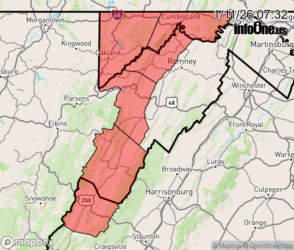 |
|||||||||
 Why aren't you using the InfoOne app? Why aren't you using the InfoOne app?
Stay abreast of information affecting your community! InfoOne tracks real-time information such as:
InfoOne currently supports over 100 communities in NC, VA and WV, and our coverage area is steadily growing. It's free! Install the InfoOne app today and see what you've been missing. |
|||||||||