|
|
Weather Alert |
| Randolph County, NC | |||||||||
|
|
||||||||
|
Canceled 5/7/26 5:30 PM Special Weather Statement issued May 7 at 4:37PM EDT by NWS Raleigh NC At 436 PM EDT, Doppler radar was tracking a strong thunderstorm 12 miles southwest of Asheboro, moving east at 35 mph. HAZARD...Wind gusts up to 40 mph and pea size hail. SOURCE...Radar indicated. IMPACT...Gusty winds could knock down tree limbs and blow around unsecured objects. Minor hail damage to vegetation is possible. Locations impacted include... Asheboro, North Carolina Zoo, Ulah, Seagrove, Robbins, Star, Steeds, Harpers Crossroads, and Highfalls. This includes Interstate 73 between Mile Markers 48 and 76. 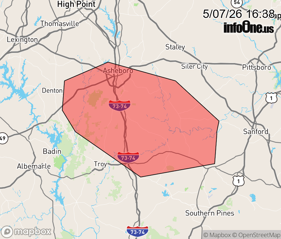 |
|||||||||
 Why aren't you using the InfoOne app? Why aren't you using the InfoOne app?
Stay abreast of information affecting your community! InfoOne tracks real-time information such as:
InfoOne currently supports over 100 communities in NC, VA and WV, and our coverage area is steadily growing. It's free! Install the InfoOne app today and see what you've been missing. |
|||||||||