|
|
Weather Alert |
| Stark County, OH | |||||||||
|
|
||||||||
|
Canceled 4/14/24 12:37 AM Flood Warning issued April 12 at 12:13AM EDT until April 12 at 4:45AM EDT by NWS Cleveland OH * WHAT... Urban area and small stream flooding caused by excessive rainfall is expected. * WHERE... A portion of northeast Ohio, including the following county, Stark. * WHEN... Until 445 AM EDT. * IMPACTS... Flooding of rivers, creeks, streams, and other low-lying and flood-prone locations is imminent or occurring. Streams continue to rise due to excess runoff from earlier rainfall, including Zimber Ditch on the West Branch of the Nimishillen River. * ADDITIONAL DETAILS... - At 1206 AM EDT, Doppler radar and automated rain gauges indicated heavy rain. Flooding is ongoing or expected to begin shortly in the warned area. Between 0.5 and 1 inch of rain has fallen. Soils are already saturated from rainfall earlier this week. - Additional rainfall amounts up to 0.5 inches are possible in the warned area. - Some locations that will experience flooding include... Canton, Massillon, Green, North Canton, Louisville, Minerva, Hartville, Brewster, Navarre, Canal Fulton, East Canton, Meyers Lake, Hills And Dales, and Perry Heights. - At 1130 PM EDT, a guage on Zimber Ditch measured a stage of 8.50 feet and rising. Flooding is expected to begin at 9.50 feet on Lucille Avenue and Furbee Avenue Southwest, along with flooding in Price Park. - http://www.weather.gov/safety/flood 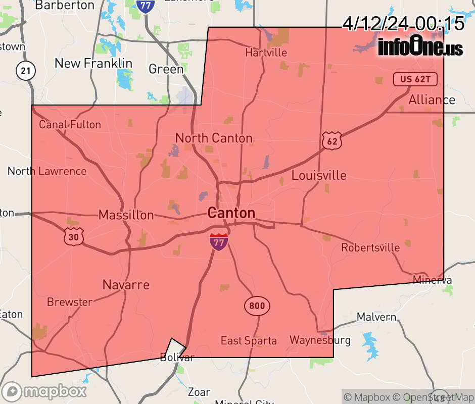 |
|||||||||
 Why aren't you using the InfoOne app? Why aren't you using the InfoOne app?
Stay abreast of information affecting your community! InfoOne tracks real-time information such as:
InfoOne currently supports over 100 communities in NC, VA and WV, and our coverage area is steadily growing. It's free! Install the InfoOne app today and see what you've been missing. |
|||||||||