|
|
Weather Alert |
| Randolph County, NC | |||||||||
|
|
||||||||
|
Canceled 6/27/22 2:30 PM Special Weather Statement issued June 27 at 1:34PM EDT by NWS Raleigh NC At 132 PM EDT, Doppler radar was tracking a cluster of strong thunderstorms along a line extending from near Walkertown to Winston- Salem to Advance. Movement was east at 30 mph. HAZARD...Winds in excess of 40 mph. SOURCE...Radar indicated. IMPACT...Gusty winds could knock down tree limbs and blow around unsecured objects. Locations impacted include... Greensboro, Winston-Salem, High Point, Lexington, Thomasville, Kernersville, Clemmons, Linwood, McLeansville and Lewisville. 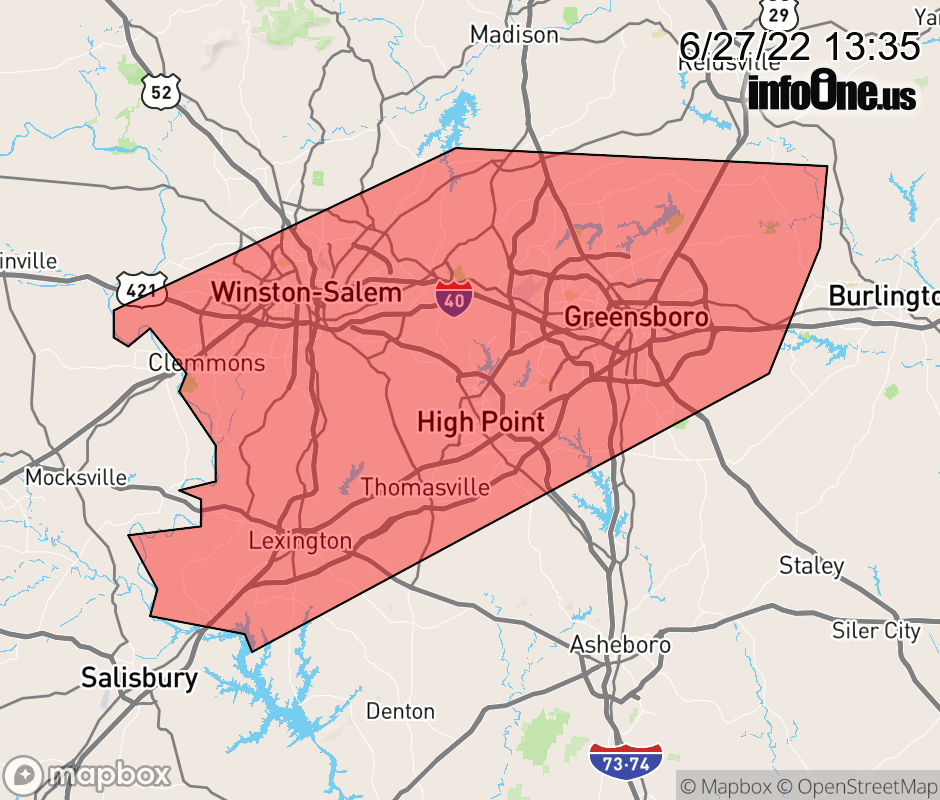 |
|||||||||
 Why aren't you using the InfoOne app? Why aren't you using the InfoOne app?
Stay abreast of information affecting your community! InfoOne tracks real-time information such as:
InfoOne currently supports over 100 communities in NC, VA and WV, and our coverage area is steadily growing. It's free! Install the InfoOne app today and see what you've been missing. |
|||||||||