|
|
Weather Alert |
| Randolph County, NC | |||||||||
|
|
||||||||
|
Canceled 7/9/25 8:51 PM Flash Flood Warning issued July 9 at 7:41PM EDT until July 9 at 10:30PM EDT by NWS Raleigh NC At 741 PM EDT, Doppler radar indicated thunderstorms producing heavy rain across the warned area. Between 2 and 4 inches of rain have fallen. The heaviest rain has fallen over northern Davidson County. Additional rainfall amounts of 1 to 2 inches are possible in the warned area. Flash flooding is ongoing or expected to begin shortly. HAZARD...Life threatening flash flooding. Thunderstorms producing flash flooding. SOURCE...Radar. IMPACT...Life threatening flash flooding of creeks and streams, urban areas, highways, streets and underpasses. Some locations that will experience flash flooding include... Greensboro, Winston-Salem, High Point, Asheboro, Lexington, Randleman, Thomasville, Kernersville, McLeansville, Archdale, Summerfield, Trinity, and Walkertown, This includes the following frequently flooded locations... Randolph St at Carolina Ave in Thomasville, Jacob St at Kanoy Rd in Thomasville, Welcome Arcadia Rd at Cecil Rd in Welcome, Kepley Craver Ave in Welcome, and Maplewood Ave in Thomasville 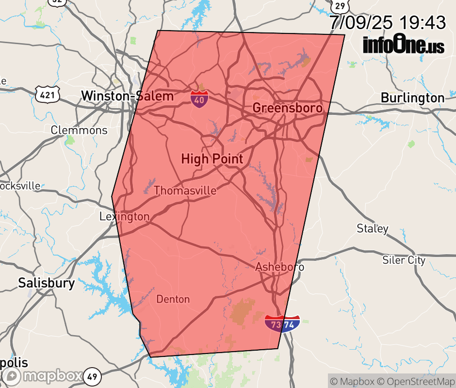 |
|||||||||
 Why aren't you using the InfoOne app? Why aren't you using the InfoOne app?
Stay abreast of information affecting your community! InfoOne tracks real-time information such as:
InfoOne currently supports over 100 communities in NC, VA and WV, and our coverage area is steadily growing. It's free! Install the InfoOne app today and see what you've been missing. |
|||||||||