|
|
Weather Alert |
| Marshall County, WV | |||||||||
|
|
||||||||
|
Canceled 4/14/26 2:45 PM Severe Thunderstorm Warning issued April 14 at 2:32PM EDT until April 14 at 3:15PM EDT by NWS Pittsburgh PA SVRPBZ The National Weather Service in Pittsburgh has issued a * Severe Thunderstorm Warning for... Southeastern Belmont County in east central Ohio... Northeastern Monroe County in east central Ohio... Southwestern Greene County in southwestern Pennsylvania... Marshall County in northern West Virginia... Northeastern Wetzel County in northern West Virginia... * Until 315 PM EDT. * At 232 PM EDT, a severe thunderstorm was located near Powhatan Point, or 9 miles southwest of Moundsville, moving east at 30 mph. HAZARD...60 mph wind gusts and small hail. SOURCE...Radar indicated. IMPACT...Expect damage to roofs, siding, and trees. * Locations impacted include... Moundsville, Powhatan Point, Glen Dale, Cameron, Hundred, Clarington, Aleppo, New Freeport, Lynn Camp, Glen Easton, Grove Oak, Beelers Station, Lone Oak, Woodlands, Wileyville, Rocklick, Proctor and Littleton. 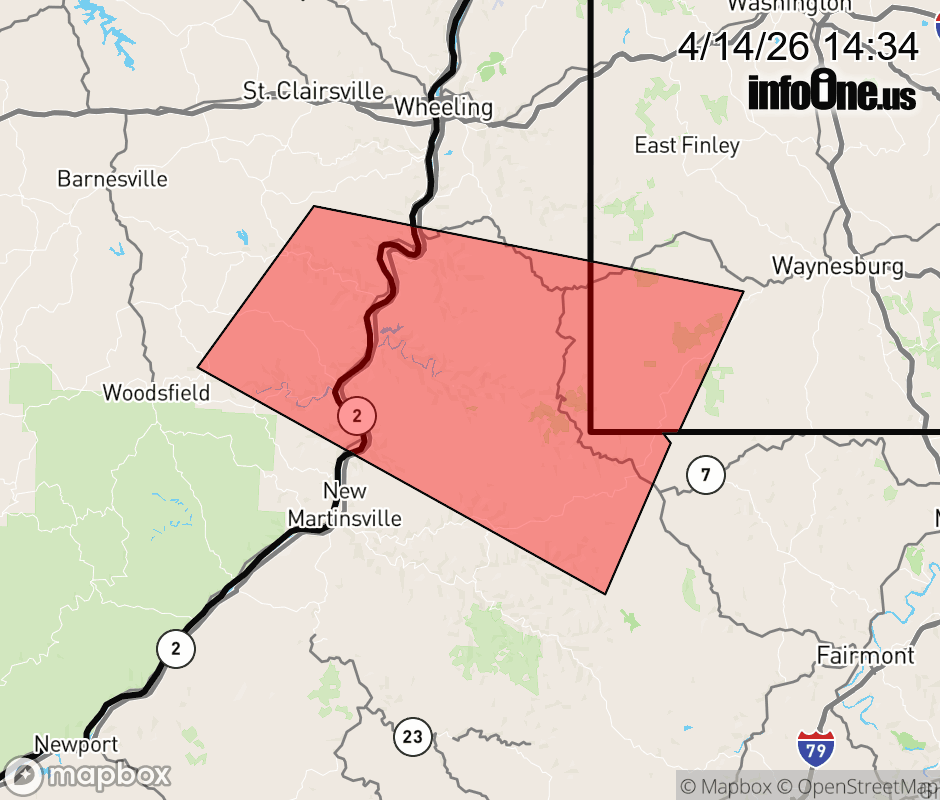 |
|||||||||
 Why aren't you using the InfoOne app? Why aren't you using the InfoOne app?
Stay abreast of information affecting your community! InfoOne tracks real-time information such as:
InfoOne currently supports over 100 communities in NC, VA and WV, and our coverage area is steadily growing. It's free! Install the InfoOne app today and see what you've been missing. |
|||||||||