|
|
Weather Alert |
| Lewis County, WV | |||||||||
|
|
||||||||
|
Canceled 7/9/25 1:35 PM Severe Thunderstorm Warning issued July 9 at 1:08PM EDT until July 9 at 1:45PM EDT by NWS Charleston WV SVRRLX The National Weather Service in Charleston West Virginia has issued a * Severe Thunderstorm Warning for... Northeastern Lewis County in northern West Virginia... Southwestern Harrison County in northern West Virginia... * Until 145 PM EDT. * At 108 PM EDT, a severe thunderstorm was located near Jackson Mill, or near Weston, moving east at 25 mph. HAZARD...60 mph wind gusts. SOURCE...Radar indicated. IMPACT...Expect damage to roofs, siding, and trees. * Locations impacted include... Weston, Jackson Mill, Stonewall Jackson, Lost Creek, Jane Lew, Camden, and Horner. This includes the following highways... Interstate 79 between mile markers 93 and 110. Route 33 between mile markers 1 and 4. 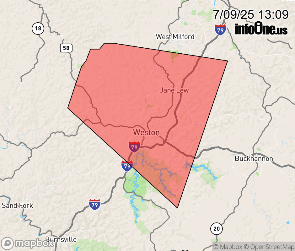 |
|||||||||
 Why aren't you using the InfoOne app? Why aren't you using the InfoOne app?
Stay abreast of information affecting your community! InfoOne tracks real-time information such as:
InfoOne currently supports over 100 communities in NC, VA and WV, and our coverage area is steadily growing. It's free! Install the InfoOne app today and see what you've been missing. |
|||||||||