
|
Weather Alert |
| Page County, VA | |||||||||
|
|
||||||||
|
Canceled 7/28/26 4:42 PM Severe Thunderstorm Warning issued July 28 at 4:26PM EDT until July 28 at 5:15PM EDT by NWS Baltimore MD/Washington DC At 426 PM EDT, severe thunderstorms were located along a line extending from near Berryville to Front Royal to 7 miles southeast of Woodstock, moving east at 15 mph. HAZARD...60 mph wind gusts and quarter size hail. SOURCE...Radar indicated. IMPACT...Damaging winds will cause some trees and large branches to fall. This could injure those outdoors, as well as damage homes and vehicles. Roadways may become blocked by downed trees. Localized power outages are possible. Unsecured light objects may become projectiles. Locations impacted include... Front Royal, Woodstock, Mount Jackson, Middleburg, Sperryville, Hume, Delaplane, Linden, Marshall, Edinburg, Chester Gap, Maurertown, Boyce, Flint Hill, Washington, Huntly, Seven Fountains, Hackleys Crossroads, Cresthill, and Karo. 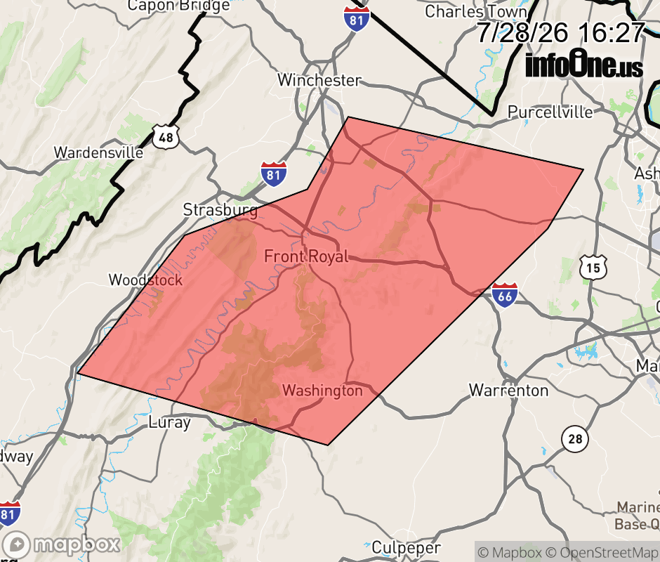 |
|||||||||
 Why aren't you using the InfoOne app? Why aren't you using the InfoOne app?
Stay abreast of information affecting your community! InfoOne tracks real-time information such as:
InfoOne currently supports over 100 communities in NC, VA and WV, and our coverage area is steadily growing. It's free! Install the InfoOne app today and see what you've been missing. |
|||||||||