|
|
Weather Alert |
| Grant County, WV | |||||||||
|
|
||||||||
|
Canceled 1/10/26 8:28 PM Winter Weather Advisory issued January 10 at 12:47PM EST until January 12 at 1:00AM EST by NWS Baltimore MD/Washington DC * WHAT... Upslope snow showers and squalls are expected late Sunday morning into Sunday night with total snow accumulations between 2 and 4 inches (locally higher amounts along western favored slopes). Winds will gust as high as 55 mph. Visibility will drop to one-quarter mile or less at times. Wind chills will fall into the single digits to 5 degrees below zero late Sunday afternoon into Sunday night. * WHERE... In Maryland, Eastern Garrett and Western Garrett Counties. In West Virginia, Western Grant and Western Pendleton Counties. * WHEN... From 8 AM Sunday to 1 AM EST Monday. * IMPACTS... Visibilities will drop below one-quarter mile at times due to falling and blowing snow. Near whiteout conditions are expected and will make travel treacherous and potentially life-threatening. Travel could be very difficult along the I-68/US-40 corridor west of La Vale, MD, US-48 corridor west of Moorefield, WV, US-33 west of Franklin, WV, and US-219 from the PA/MD line to WV line. The hazardous conditions will impact commuters Sunday into Sunday night. Gusty winds could bring down large tree branches. * ADDITIONAL DETAILS... The greatest concern for near-blizzard conditions is expected with the cold front late morning into early afternoon as well as a secondary round of upslope snow showers/squalls late afternoon into late evening. 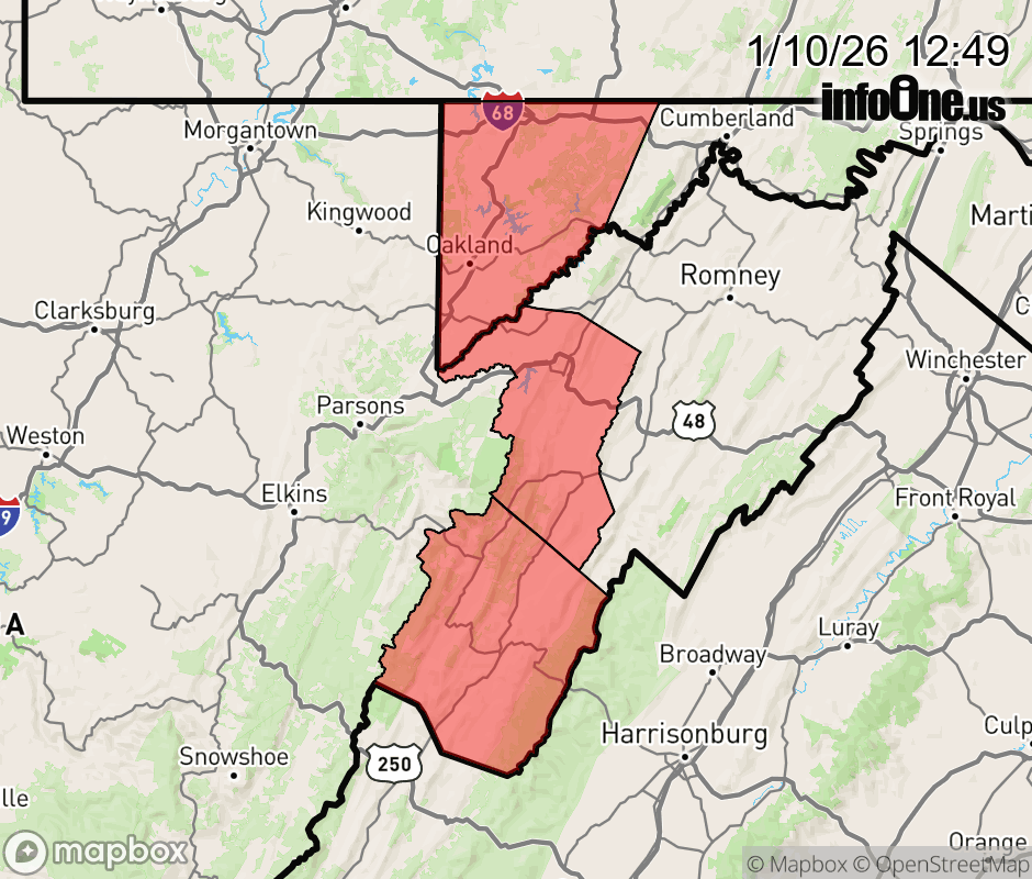 |
|||||||||
 Why aren't you using the InfoOne app? Why aren't you using the InfoOne app?
Stay abreast of information affecting your community! InfoOne tracks real-time information such as:
InfoOne currently supports over 100 communities in NC, VA and WV, and our coverage area is steadily growing. It's free! Install the InfoOne app today and see what you've been missing. |
|||||||||