|
|
Weather Alert |
| Lawrence County, OH | |||||||||
|
|
||||||||
|
Canceled 4/3/25 4:15 AM Severe Thunderstorm Warning issued April 3 at 3:53AM EDT until April 3 at 4:15AM EDT by NWS Charleston WV SVRRLX The National Weather Service in Charleston West Virginia has issued a * Severe Thunderstorm Warning for... West central Boyd County in northeastern Kentucky... Greenup County in northeastern Kentucky... Carter County in northeastern Kentucky... West central Lawrence County in southeastern Ohio... * Until 415 AM EDT. * At 352 AM EDT, severe thunderstorms were located along a line extending from Rome to Clearfield, moving northeast at 60 mph. HAZARD...60 mph wind gusts and penny size hail. SOURCE...Radar indicated. IMPACT...Expect damage to roofs, siding, and trees. * Locations impacted include... Coalton, Brushart, Carter, Hitchins, Warnock, Gesling, Soldier, Greenbo Lake, Oldtown, Globe, Naples, Grays Branch, Grayson, Rush, Greenup, Grahn, Load, Olive Hill, Hopewell, and South Shore. This includes Interstate 64 in Kentucky between mile markers 149 and 181. 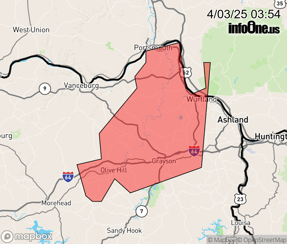 |
|||||||||
 Why aren't you using the InfoOne app? Why aren't you using the InfoOne app?
Stay abreast of information affecting your community! InfoOne tracks real-time information such as:
InfoOne currently supports over 100 communities in NC, VA and WV, and our coverage area is steadily growing. It's free! Install the InfoOne app today and see what you've been missing. |
|||||||||