|
|
Weather Alert |
| Floyd County, VA | |||||||||
|
|
||||||||
|
Canceled 7/18/25 3:41 PM Severe Thunderstorm Warning issued July 18 at 3:15PM EDT until July 18 at 4:15PM EDT by NWS Blacksburg VA SVRRNK The National Weather Service in BLACKSBURG has issued a * Severe Thunderstorm Warning for... Southwestern Roanoke County in west central Virginia... East central Pulaski County in southwestern Virginia... The City of Radford in southwestern Virginia... Northeastern Floyd County in southwestern Virginia... Northwestern Franklin County in west central Virginia... Montgomery County in southwestern Virginia... * Until 415 PM EDT. * At 314 PM EDT, a severe thunderstorm was located over Merrimac, or near Blacksburg, moving east at 25 mph. A separate severe thunderstorm was located just south of the City of Radford, moving at a similar speed and direction. HAZARD...60 mph wind gusts and quarter size hail. SOURCE...Radar indicated. IMPACT...Hail damage to vehicles is expected. Expect wind damage to roofs, siding, and trees. * Locations impacted include... Blacksburg... Christiansburg... Radford... Pilot... Copper Hill... Shawsville... and Bent Mountain. 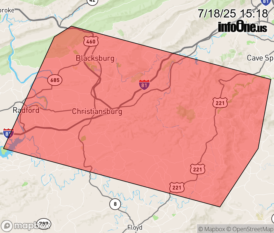 |
|||||||||
 Why aren't you using the InfoOne app? Why aren't you using the InfoOne app?
Stay abreast of information affecting your community! InfoOne tracks real-time information such as:
InfoOne currently supports over 100 communities in NC, VA and WV, and our coverage area is steadily growing. It's free! Install the InfoOne app today and see what you've been missing. |
|||||||||