|
|
Weather Alert |
| Summit County, OH | |||||||||
|
|
||||||||
|
Canceled 6/18/25 2:42 PM Severe Thunderstorm Warning issued June 18 at 2:25PM EDT until June 18 at 3:15PM EDT by NWS Cleveland OH SVRCLE The National Weather Service in Cleveland has issued a * Severe Thunderstorm Warning for... Medina County in northeastern Ohio... Northeastern Ashland County in north central Ohio... West central Summit County in northeastern Ohio... Northern Wayne County in northeastern Ohio... South central Lorain County in north central Ohio... * Until 315 PM EDT. * At 225 PM EDT, a severe thunderstorm was located over Lodi, or 10 miles southwest of Medina, moving east at 35 mph. HAZARD...60 mph wind gusts and penny size hail. SOURCE...Radar indicated. IMPACT...Expect damage to trees and power lines. * Locations impacted include... Medina, Barberton, Wadsworth, Rittman, Doylestown, Lodi, Creston, West Salem, Chippewa Lake, Norton, Fairlawn, Richfield, Seville, Penfield, Westfield Center, Marshallville, Spencer, Gloria Glens Park, Burbank, and Chippewa-On-The-Lake. 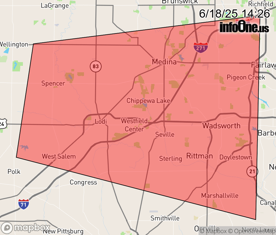 |
|||||||||
 Why aren't you using the InfoOne app? Why aren't you using the InfoOne app?
Stay abreast of information affecting your community! InfoOne tracks real-time information such as:
InfoOne currently supports over 100 communities in NC, VA and WV, and our coverage area is steadily growing. It's free! Install the InfoOne app today and see what you've been missing. |
|||||||||