|
|
Weather Alert |
| Charlottesville City, VA | |||||||||
|
|
||||||||
|
Canceled 2/10/25 9:22 PM Winter Storm Warning issued February 10 at 2:51PM EST until February 12 at 7:00AM EST by NWS Baltimore MD/Washington DC * WHAT... Heavy mixed precipitation expected. Total snow and sleet accumulations between 4 and 8 inches with localized amounts around 10 inches on the ridges. Ice accumulations up to one tenth of an inch. * WHERE... Portions of central, northwest, and western Virginia and eastern West Virginia. * WHEN... From 10 AM Tuesday to 7 AM EST Wednesday. Snow will overspread the area Tuesday morning, with the steadiest snow expected Tuesday afternoon and evening. Snow will mix with sleet and freezing rain at times Tuesday night into early Wednesday morning. A light wintry mix is possible Wednesday. * IMPACTS... Travel could be very difficult. The hazardous conditions could impact the Tuesday evening and Wednesday morning commutes. * ADDITIONAL DETAILS... Snowfall around 1 to 2 inches per hour are possible Tuesday afternoon and evening. 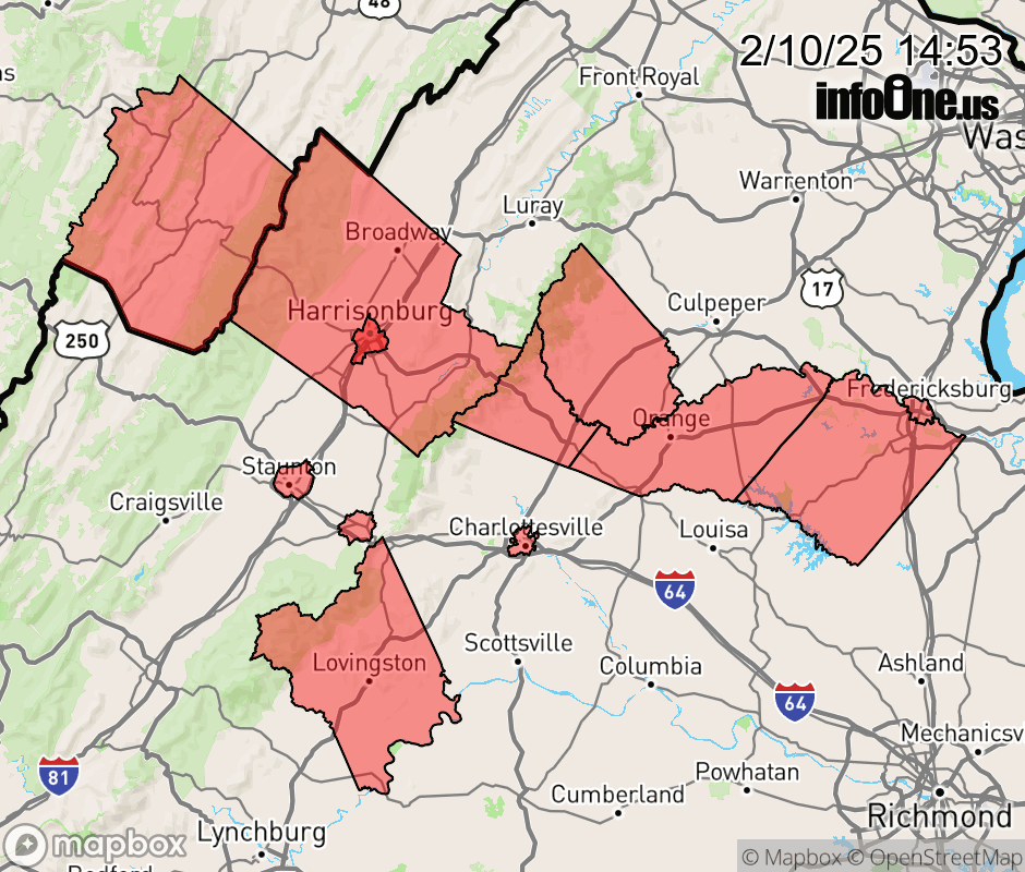 |
|||||||||
 Why aren't you using the InfoOne app? Why aren't you using the InfoOne app?
Stay abreast of information affecting your community! InfoOne tracks real-time information such as:
InfoOne currently supports over 100 communities in NC, VA and WV, and our coverage area is steadily growing. It's free! Install the InfoOne app today and see what you've been missing. |
|||||||||