|
|
Weather Alert |
| Orange County, NC | |||||||||
|
|
||||||||
|
Canceled 3/16/26 12:30 PM Special Weather Statement issued March 16 at 11:29AM EDT by NWS Raleigh NC At 1129 AM EDT, Doppler radar was tracking strong thunderstorms along a line extending from near Baynes to 7 miles northwest of Pittsboro to 7 miles northwest of Carthage. Movement was northeast at 55 mph. HAZARD...Wind gusts of 50 to 55 mph. SOURCE...Radar indicated. IMPACT...Gusty winds could knock down tree limbs and blow around unsecured objects. Locations impacted include... Raleigh, Durham, Cary, Chapel Hill, Burlington, Sanford, Graham, Roxboro, Hillsborough, and Creedmoor. This includes the following highways... Interstate 85 between Mile Markers 163 and 201. Interstate 40 between Mile Markers 144 and 162, and between Mile Markers 259 and 296. Interstate 440 between Mile Markers 1 and 8. Interstate 540 between Mile Markers 0 and 14. US 1 between Mile Markers 69 and 101. the Durham Freeway between Mile Markers 2 and 17. 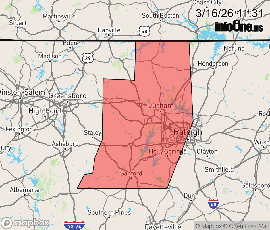 |
|||||||||
 Why aren't you using the InfoOne app? Why aren't you using the InfoOne app?
Stay abreast of information affecting your community! InfoOne tracks real-time information such as:
InfoOne currently supports over 100 communities in NC, VA and WV, and our coverage area is steadily growing. It's free! Install the InfoOne app today and see what you've been missing. |
|||||||||