|
|
Weather Alert |
| Portage County, OH | |||||||||
|
|
||||||||
|
Canceled 10/21/21 6:30 PM Tornado Warning issued October 21 at 5:51PM EDT until October 21 at 6:30PM EDT by NWS Cleveland OH The National Weather Service in Cleveland has issued a * Tornado Warning for... East central Portage County in northeastern Ohio... Southwestern Trumbull County in northeastern Ohio... Northwestern Mahoning County in northeastern Ohio... * Until 630 PM EDT. * At 550 PM EDT, a severe thunderstorm capable of producing a tornado was located near Newton Falls, or 11 miles east of Ravenna, moving east at 30 mph. HAZARD...Tornado. SOURCE...Radar indicated rotation. IMPACT...Flying debris will be dangerous to those caught without shelter. Mobile homes will be damaged or destroyed. Damage to roofs, windows, and vehicles will occur. Tree damage is likely. * This dangerous storm will be near... Newton Falls around 600 PM EDT. Lordstown around 610 PM EDT. Warren around 615 PM EDT. Niles and Hilltop around 620 PM EDT. Youngstown and Vienna Center around 630 PM EDT. Other locations impacted by this tornadic thunderstorm include McDonald, North Jackson, Mineral Ridge, Craig Beach, South Canal, Girard, Vienna, Churchill, Howland Center, Bolindale and Austintown. 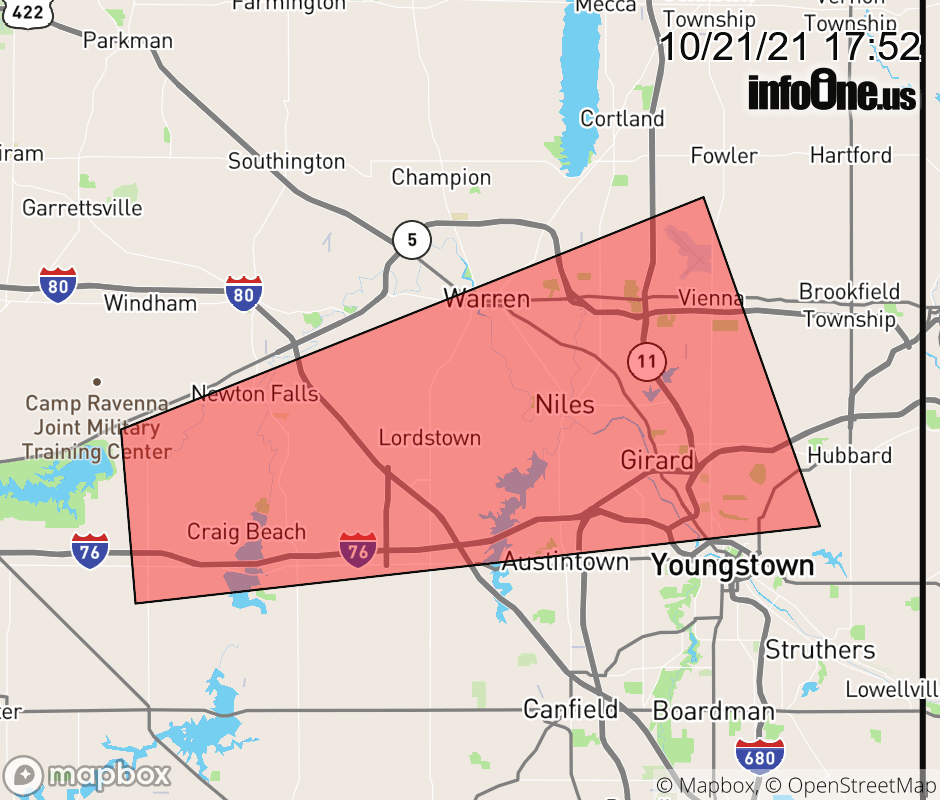 |
|||||||||
 Why aren't you using the InfoOne app? Why aren't you using the InfoOne app?
Stay abreast of information affecting your community! InfoOne tracks real-time information such as:
InfoOne currently supports over 100 communities in NC, VA and WV, and our coverage area is steadily growing. It's free! Install the InfoOne app today and see what you've been missing. |
|||||||||