|
|
Weather Alert |
| Pendleton County, WV | |||||||||
|
|
||||||||
|
Canceled 1/25/26 7:54 PM Winter Storm Warning issued January 25 at 12:19PM EST until January 26 at 10:00AM EST by NWS Baltimore MD/Washington DC ...MAJOR WINTER STORM WILL IMPACT THE REGION THROUGH THIS EVENING... .A large area of precipitation will overrun Arctic air in place over the Mid-Atlantic. This will lead to widespread sleet across the region, with the potential for ice today, especially south of Highway 50 and near and east of Interstate 95. In addition to the high threat for significant snow, sleet, and ice, very cold temperatures are expected tonight through much of the week with sub-zero wind chills likely at times. * WHAT... Heavy mixed precipitation. Additional snow and sleet accumulations between 1 and 3 inches, with ice accumulations around one to two tenths of an inch along and west of the Allegheny Front. Winds gusting as high as 45 mph. * WHERE... Portions of western Maryland, western Virginia, and eastern West Virginia. * WHEN... Until 10 AM EST Monday. * IMPACTS... Plan on slippery road conditions. The hazardous conditions could impact the Monday morning commute. Gusty winds could bring down tree branches. * ADDITIONAL DETAILS... A mixture of snow, sleet, and freezing rain will continue through the afternoon hours. The highest threat for more significant icing would be along and west of the Allegheny Front. Precipitation is most likely to change back to snow and linger west of the Allegheny Front tonight into Monday morning. A prolonged period of sub-zero wind chills continues this evening and lasting through much of the week. 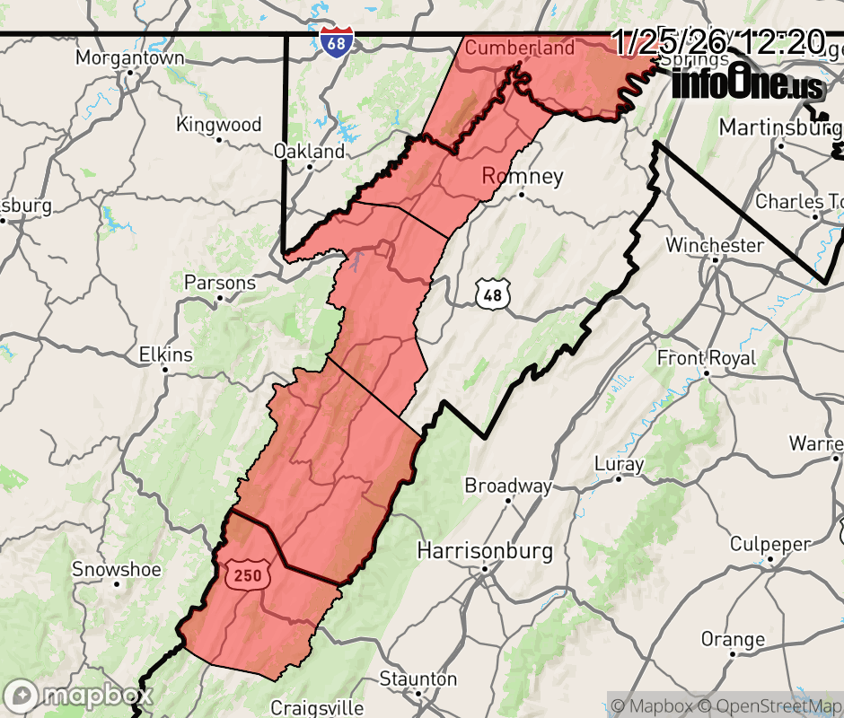 |
|||||||||
 Why aren't you using the InfoOne app? Why aren't you using the InfoOne app?
Stay abreast of information affecting your community! InfoOne tracks real-time information such as:
InfoOne currently supports over 100 communities in NC, VA and WV, and our coverage area is steadily growing. It's free! Install the InfoOne app today and see what you've been missing. |
|||||||||