|
|
Weather Alert |
| Medina County, OH | |||||||||
|
|
||||||||
|
Canceled 3/31/26 5:05 PM Severe Thunderstorm Warning issued March 31 at 4:40PM EDT until March 31 at 5:30PM EDT by NWS Cleveland OH SVRCLE The National Weather Service in Cleveland has issued a * Severe Thunderstorm Warning for... Huron County in north central Ohio... Northern Richland County in north central Ohio... Eastern Seneca County in northwestern Ohio... Erie County in north central Ohio... Southwestern Cuyahoga County in northeastern Ohio... Western Medina County in northeastern Ohio... Northern Ashland County in north central Ohio... Southeastern Sandusky County in northwestern Ohio... Northern Crawford County in north central Ohio... Lorain County in north central Ohio... * Until 530 PM EDT. * At 440 PM EDT, severe thunderstorms were located along a line extending from 9 miles east of Kelleys Island to near Bellevue to near Chatfield, moving east at 60 mph. HAZARD...70 mph wind gusts and penny size hail. SOURCE...Radar indicated. IMPACT...Expect considerable tree damage. Damage is likely to mobile homes, roofs, and outbuildings. * Locations impacted include... Cleveland, Lorain, Elyria, Sandusky, Norwalk, Vermilion, Western Vermilion, Lakewood, Strongsville, Westlake, North Ridgeville, Avon Lake, Amherst, Bellevue, Grafton, Willard, Wellington, New London, Plymouth, and Northern Milan. 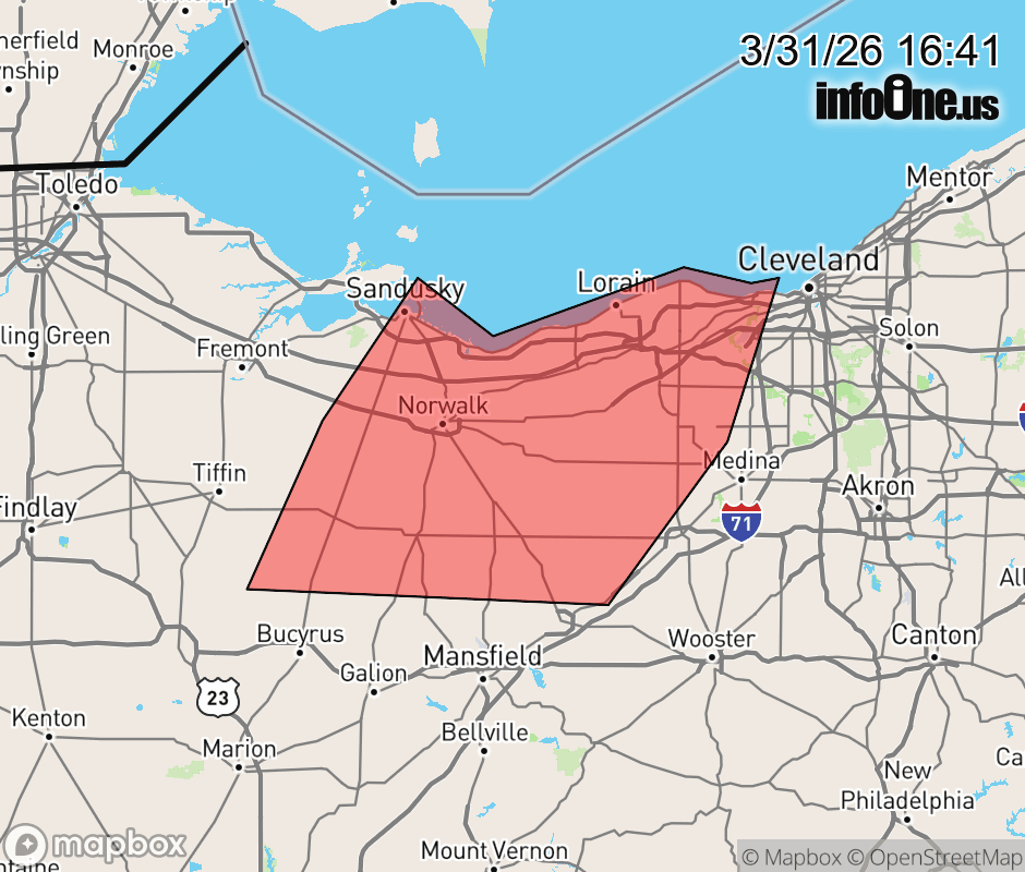 |
|||||||||
 Why aren't you using the InfoOne app? Why aren't you using the InfoOne app?
Stay abreast of information affecting your community! InfoOne tracks real-time information such as:
InfoOne currently supports over 100 communities in NC, VA and WV, and our coverage area is steadily growing. It's free! Install the InfoOne app today and see what you've been missing. |
|||||||||