|
|
Weather Alert |
| Marshall County, WV | |||||||||
|
|
||||||||
|
Canceled 4/14/26 2:57 PM Severe Thunderstorm Warning issued April 14 at 2:42PM EDT until April 14 at 3:15PM EDT by NWS Pittsburgh PA At 242 PM EDT, a severe thunderstorm was located near Powhatan Point, or 7 miles south of Moundsville, moving east at 30 mph. HAZARD...60 mph wind gusts and quarter size hail. SOURCE...Radar indicated. IMPACT...Hail damage to vehicles is expected. Expect wind damage to roofs, siding, and trees. Locations impacted include... Moundsville, Powhatan Point, Cameron, Hundred, Clarington, Aleppo, New Freeport, Glen Easton, Lynn Camp, Beelers Station, Littleton, Lone Oak, Rocklick, Knob Fork, Grove Oak, Woodlands, Earnshaw and Burton. 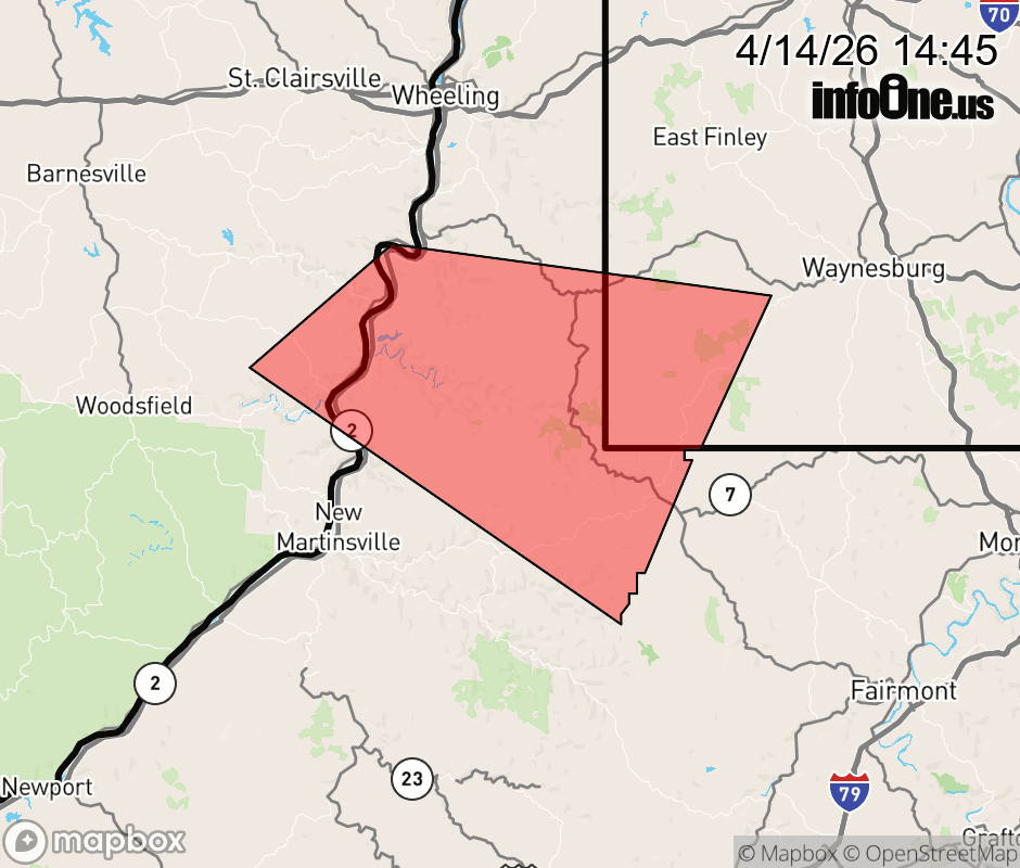 |
|||||||||
 Why aren't you using the InfoOne app? Why aren't you using the InfoOne app?
Stay abreast of information affecting your community! InfoOne tracks real-time information such as:
InfoOne currently supports over 100 communities in NC, VA and WV, and our coverage area is steadily growing. It's free! Install the InfoOne app today and see what you've been missing. |
|||||||||