|
|
Weather Alert |
| Hardy County, WV | |||||||||
|
|
||||||||
|
Canceled 3/1/21 8:47 PM Flood Warning issued March 1 at 10:15AM EST until March 2 at 7:20AM EST by NWS Baltimore MD/Washington DC The Flood Warning continues for the South Branch Potomac River near Springfield. * Until Tuesday morning. * At 9:30 AM EST Monday the stage was 15.0 feet, or 0.0 feet above flood stage. * Flood stage is 15.0 feet. * Minor flooding is occurring and minor flooding is forecast. * Recent Activity... The maximum river stage in the 24 hours ending at 9:30 AM EST Monday was 15.0 feet. * Forecast... The river is expected to rise to a crest of 15.7 feet this evening. It will then fall below flood stage just after midnight tonight. * Impact... At 15.0 feet, Milleson Mill Road (County Route 28/5) and Clarence Taylor Road (Route 3/7) begin to flood. Water covers a significant portion of meadowlands near the river. The boat launch ramp on the upstream right abutment of the bridge also floods. * Flood History... This crest compares to a previous crest of 15.7 feet on 03/27/1978. 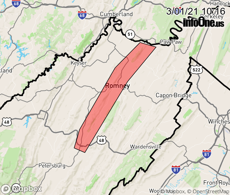 |
|||||||||
 Why aren't you using the InfoOne app? Why aren't you using the InfoOne app?
Stay abreast of information affecting your community! InfoOne tracks real-time information such as:
InfoOne currently supports over 100 communities in NC, VA and WV, and our coverage area is steadily growing. It's free! Install the InfoOne app today and see what you've been missing. |
|||||||||