|
|
Weather Alert |
| Logan County, WV | |||||||||
|
|
||||||||
|
Canceled 9/6/25 2:00 AM Special Weather Statement issued September 6 at 1:26AM EDT by NWS Charleston WV At 126 AM EDT, Doppler radar was tracking strong thunderstorms along a line extending from 7 miles southwest of Madison to near Man to Argo. Movement was east at 25 mph. HAZARD...Wind gusts up to 40 mph and pea size hail. SOURCE...Radar indicated. IMPACT...Gusty winds could knock down tree limbs and blow around unsecured objects. Minor hail damage to vegetation is possible. Locations impacted include... Welch, Pineville, Mullens, Oceana, Gary, Man, Hanover, Van, R.d. Bailey Lake, Gilbert Creek, Bald Knob, Mallory, Amherstdale-Robinette, Twin Falls State Park, Wharton, Whitesville, Gilbert, Davy, Iaeger, and Kimball. This includes Route 119 near mile marker 44. 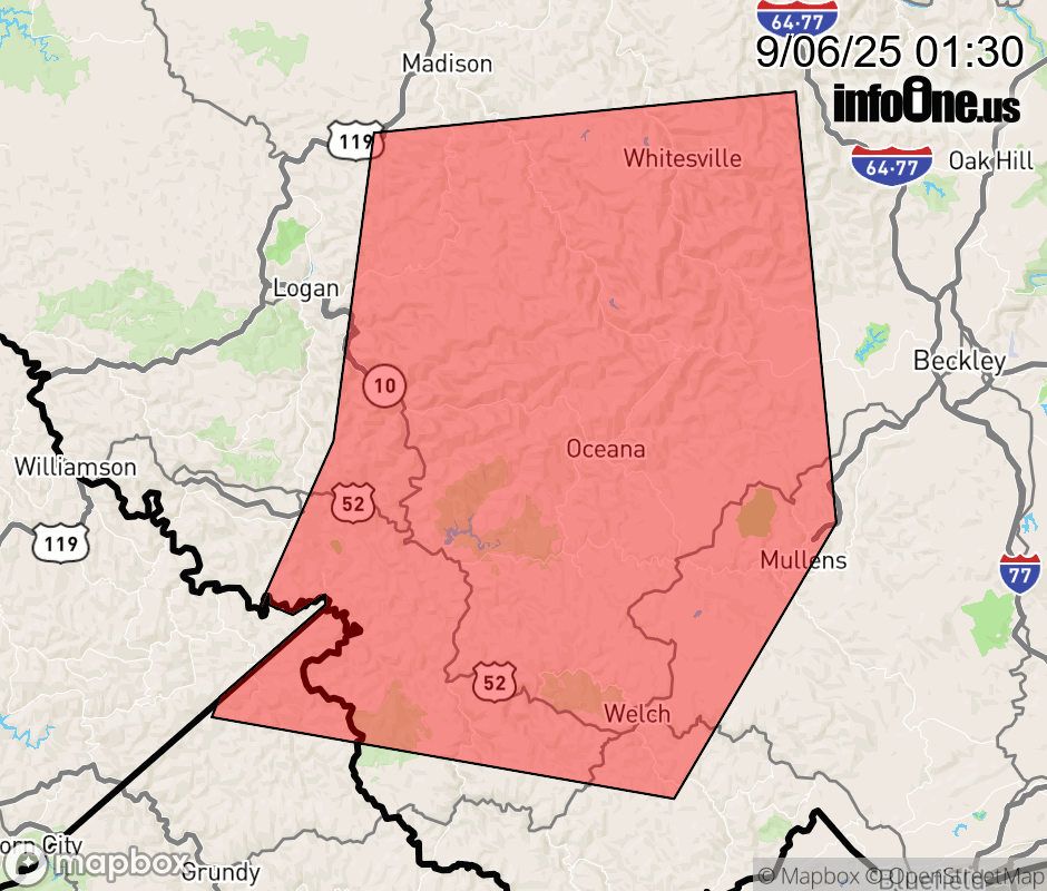 |
|||||||||
 Why aren't you using the InfoOne app? Why aren't you using the InfoOne app?
Stay abreast of information affecting your community! InfoOne tracks real-time information such as:
InfoOne currently supports over 100 communities in NC, VA and WV, and our coverage area is steadily growing. It's free! Install the InfoOne app today and see what you've been missing. |
|||||||||