|
|
Weather Alert |
| Marshall County, WV | |||||||||
|
|
||||||||
|
Canceled 4/14/24 12:37 AM Flood Warning issued April 12 at 11:30PM EDT until April 14 at 8:31PM EDT by NWS Pittsburgh PA ...The Flood Warning continues for the following rivers in Pennsylvania...West Virginia...Ohio... Allegheny River At CW Bill Young Dam affecting Allegheny County. Ohio River At Powhatan Point affecting Belmont, Marshall and Monroe Counties. Ohio River At Moundsville affecting Marshall County. Ohio River At Wheeling affecting Belmont and Ohio Counties. Ohio River At Pike Island affecting Belmont, Ohio and Jefferson OH Counties. Ohio River Near New Cumberland affecting Hancock and Jefferson OH Counties. Ohio River At Wellsville affecting Columbiana County. Ohio River At Montgomery affecting Beaver, Columbiana and Hancock Counties. Ohio River At Wellsburg affecting Brooke and Jefferson OH Counties. Ohio River At Steubenville affecting Brooke and Jefferson OH Counties. Ohio River At East Liverpool affecting Beaver, Columbiana, Hancock and Jefferson OH Counties. Ohio River At Hannibal affecting Wetzel, Tyler and Monroe Counties. ...The Flood Warning is extended for the following rivers in Pennsylvania... Ohio River At Pittsburgh affecting Allegheny County. * WHAT... Moderate flooding is forecast. * WHERE... Ohio River at Powhatan Point. * WHEN... Until Sunday evening. * IMPACTS... At 37.0 feet, Minor flooding begins near the intersection of Sarich and Seymour Streets, the intersection of Water and Second Streets, and on Mellott Street near the railroad tracks. At 38.0 feet, Flooding begins on Water and Mellot Streets. At 39.0 feet, Flooding begins near the water treatment plant. At 40.0 feet, The bridge on Route 7 over Captina Creek is flooded. At 41.0 feet, Most of downtown Powhatan Point south of Captina Creek is flooded with the exception of a small portion of First Street. * ADDITIONAL DETAILS... - At 11:00 PM EDT Friday the stage was 35.7 feet. - Bankfull stage is 37.0 feet. - Forecast...The river is expected to rise above flood stage just after midnight tonight to a crest of 40.0 feet tomorrow evening. It will then fall below flood stage early Sunday afternoon. - Flood stage is 37.0 feet. - Flood History...No available flood history. - http://www.weather.gov/safety/flood 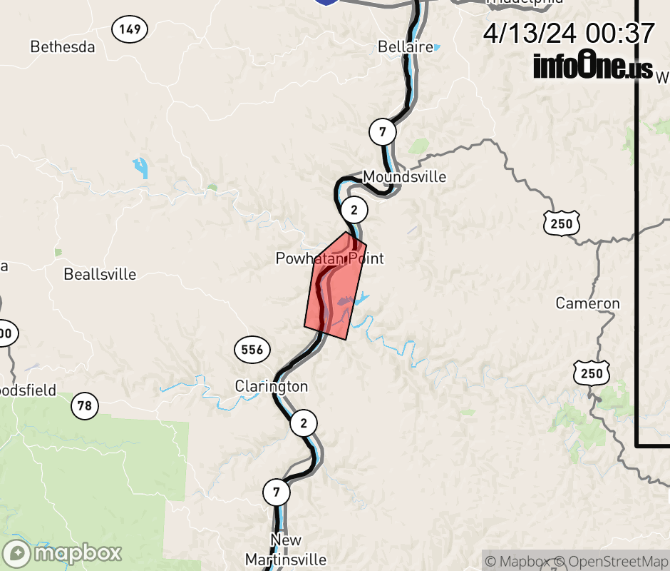 |
|||||||||
 Why aren't you using the InfoOne app? Why aren't you using the InfoOne app?
Stay abreast of information affecting your community! InfoOne tracks real-time information such as:
InfoOne currently supports over 100 communities in NC, VA and WV, and our coverage area is steadily growing. It's free! Install the InfoOne app today and see what you've been missing. |
|||||||||