|
|
Weather Alert |
| Prince Edward County, VA | |||||||||
|
|
||||||||
|
Canceled 6/15/25 5:30 PM Special Weather Statement issued June 15 at 4:28PM EDT by NWS Wakefield VA At 428 PM EDT, Doppler radar was tracking strong thunderstorms along a line extending from near Madisonville to near Wylliesburg to Hitesburg. Movement was northeast at 20 mph. HAZARD...Wind gusts up to 40 mph, heavy rain, and frequent lightning. SOURCE...Radar indicated. IMPACT...Gusty winds could knock down tree limbs and blow around unsecured objects. Reduced visibility and minor flooding possible. Frequent cloud to ground lightning strikes. Strong thunderstorms will be near... Buffalo Springs and Darlington Heights around 435 PM EDT. Clarksville around 445 PM EDT. Chase City and Hampden Sydney around 450 PM EDT. Hampden Sydney College and Kells Corner around 500 PM EDT. Farmville and Rehoboth around 510 PM EDT. Longwood University around 515 PM EDT. Other locations impacted by these storms include Raines Tavern, Tuggle, Prince Edward Station, Spanish Grove, Briery, Arvins Store, Twin Lakes State Park, Finchley, Finneywood, and Nutbush. 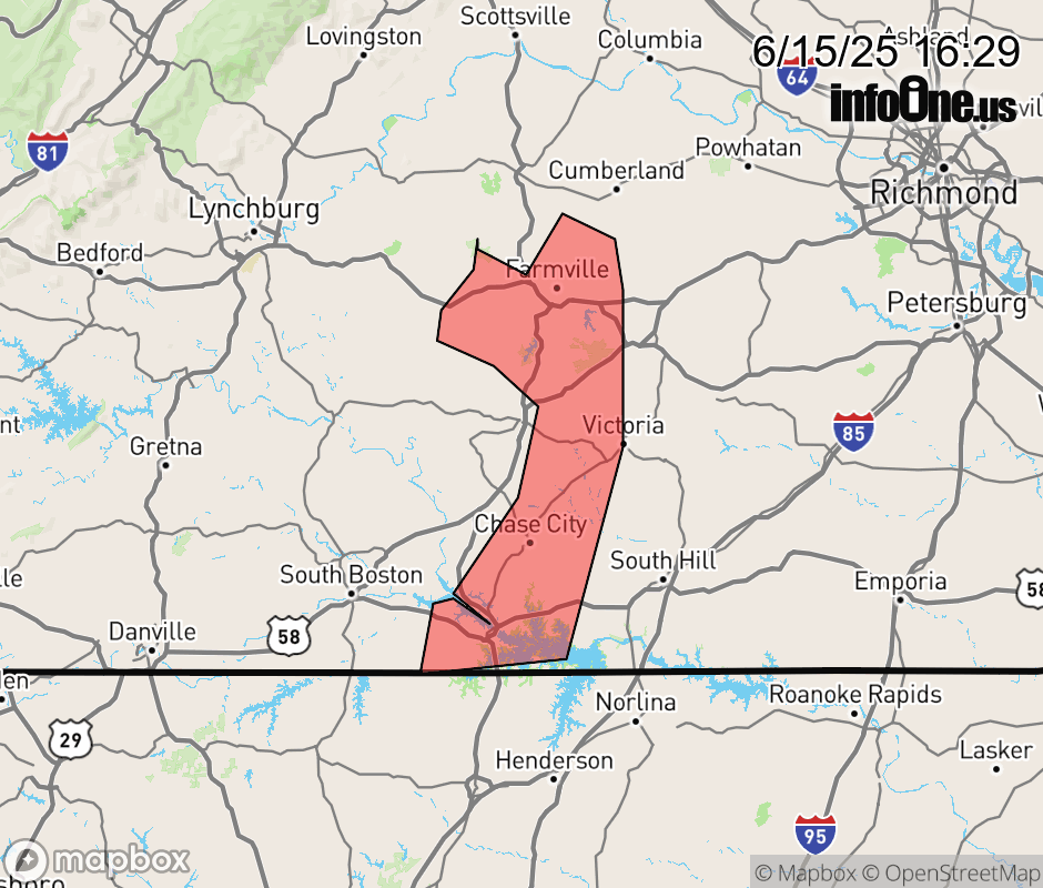 |
|||||||||
 Why aren't you using the InfoOne app? Why aren't you using the InfoOne app?
Stay abreast of information affecting your community! InfoOne tracks real-time information such as:
InfoOne currently supports over 100 communities in NC, VA and WV, and our coverage area is steadily growing. It's free! Install the InfoOne app today and see what you've been missing. |
|||||||||