|
|
Weather Alert |
| Forsyth County, NC | |||||||||
|
|
||||||||
|
Canceled 5/29/23 2:15 AM Flood Advisory issued May 28 at 11:09PM EDT until May 29 at 2:15AM EDT by NWS Raleigh NC * WHAT... Flooding caused by excessive rainfall is expected. * WHERE... Northern and central Forsyth County, including the cities of Winston-Salem, Stanleyville, and Walkertown. * WHEN... Until 215 AM EDT. * IMPACTS... Flooding of rivers, creeks, streams, and other low-lying and flood-prone locations is imminent or occurring. * ADDITIONAL DETAILS... - At 1107 PM EDT, Doppler radar and automated rain gauges indicated heavy rain due to thunderstorms. Minor flooding is ongoing or expected to begin shortly in the advisory area. Between 1 and 2 inches of rain have fallen. - Additional rainfall amounts up to 1 inch are expected over the area. This additional rain will result in minor flooding. - Some locations that will experience flooding include... Winston-Salem, High Point, Kernersville, King, Lewisville, Walkertown, Rural Hall, Stanleyville, Pfafftown and Sedge Garden. - This includes the following flood prone locations... Bethania Station Rd at Bethabara Park Blvd, Reynolda Rd at Bethabara Park Blvd, S Main St at E Salem Ave, Hawthorne Rd at W 1st St, Northwest Blvd at Thurmond St, Phillips Bridge Rd at Muddy Creek, Indiana Ave at E 28th St, Waterworks Rd at Frazier Creek, University Pkwy at Coliseum Dr and Old Town Dr near Bethania Station Rd. - http://www.weather.gov/safety/flood 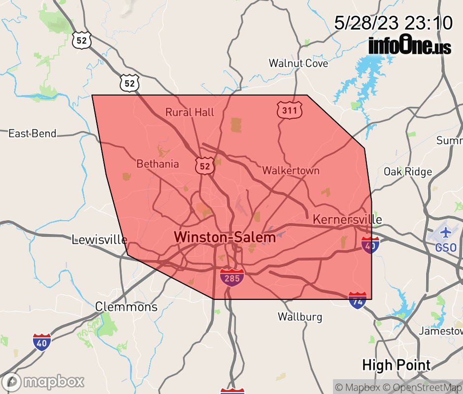 |
|||||||||
 Why aren't you using the InfoOne app? Why aren't you using the InfoOne app?
Stay abreast of information affecting your community! InfoOne tracks real-time information such as:
InfoOne currently supports over 100 communities in NC, VA and WV, and our coverage area is steadily growing. It's free! Install the InfoOne app today and see what you've been missing. |
|||||||||