|
|
Weather Alert |
| Clay County, WV | |||||||||
|
|
||||||||
|
Canceled 2/1/25 3:57 AM Flood Warning issued January 31 at 9:24PM EST until February 1 at 4:00AM EST by NWS Charleston WV * WHAT... Urban area, stream, and river flooding caused by prior rainfall and melting snowpack continues, with the potential for isolated rock falls and landslides in some areas. * WHERE... Portions of central and northern West Virginia, including the following counties, in central West Virginia, Braxton, Clay, Nicholas and Webster. In northern West Virginia, Pocahontas, Randolph and Upshur. * WHEN... Until 400 AM EST Saturday. * IMPACTS... Flooding of rivers, creeks, streams, and other low-lying and flood-prone locations is imminent or occurring. Streams and rivers continue to rise due to excess runoff from earlier rainfall and melting snowpack. Isolated rock falls and landslides remain possible. * ADDITIONAL DETAILS... - At 917 PM EST, Several creeks and rivers are near or over flood stage. Additionally, high water continues to impact some roads across the warned area. - Some locations that will experience flooding include... Elkins, Summersville, Richwood, Marlinton, Clay, Webster Springs, Cass Scenic Railroad, Greenbank, Addison (Webster Springs), Mill Creek, Camden-On-gauley, Holly River State Park, Snowshoe, Camden On Gauley, Dailey, Craigsville, Birch River, Harrison, Mingo and Beverly. - http://www.weather.gov/safety/flood 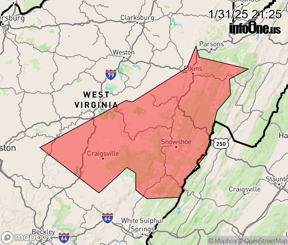 |
|||||||||
 Why aren't you using the InfoOne app? Why aren't you using the InfoOne app?
Stay abreast of information affecting your community! InfoOne tracks real-time information such as:
InfoOne currently supports over 100 communities in NC, VA and WV, and our coverage area is steadily growing. It's free! Install the InfoOne app today and see what you've been missing. |
|||||||||