|
|
Weather Alert |
| Wyoming County, WV | |||||||||
|
|
||||||||
|
Canceled 3/16/26 6:25 AM Severe Thunderstorm Warning issued March 16 at 6:16AM EDT until March 16 at 6:30AM EDT by NWS Charleston WV At 616 AM EDT, severe thunderstorms were located along a line extending from near Hawks Nest State Park to 6 miles west of Bradley to Twin Falls State Park, moving east at 30 mph. HAZARD...60 mph wind gusts. SOURCE...Radar indicated. IMPACT...Expect damage to roofs, siding, and trees. Locations impacted include... Beckley, Fayetteville, Oak Hill, Mount Hope, Mabscott, Ansted, Sophia, Gauley Bridge, Crab Orchard, Dry Creek, Macarthur, Bradley, Hawks Nest State Park, Piney View, Stanaford, Prosperity, Twin Falls State Park, Powellton, Lester, and Pax. 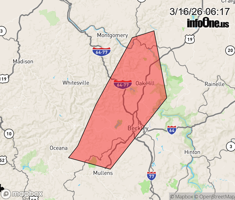 |
|||||||||
 Why aren't you using the InfoOne app? Why aren't you using the InfoOne app?
Stay abreast of information affecting your community! InfoOne tracks real-time information such as:
InfoOne currently supports over 100 communities in NC, VA and WV, and our coverage area is steadily growing. It's free! Install the InfoOne app today and see what you've been missing. |
|||||||||