|
|
Weather Alert |
| Ohio County, WV | |||||||||
|
|
||||||||
|
Flood Watch issued July 5 at 11:03AM EDT until July 5 at 10:00PM EDT by NWS Pittsburgh PA * WHAT... Flash flooding caused by excessive rainfall is possible. * WHERE... Portions of east central Ohio, including the following area, Columbiana, Pennsylvania, including the following areas, Allegheny, Armstrong, Beaver, Butler, Fayette, Higher Elevations of Fayette, Higher Elevations of Indiana, Higher Elevations of Westmoreland, Indiana, Lawrence, Mercer, Washington and Westmoreland, and West Virginia, including the following areas, Brooke, Hancock and Ohio. * WHEN... From 3 PM this afternoon to 10 PM EDT this evening. * IMPACTS... Excessive runoff may result in flooding of creeks, streams, and other low-lying and flood-prone locations. Not every location in the flash flood watch will see rain, however downpours are likely with any shower or storm. * ADDITIONAL DETAILS... - rainfall that occurred Saturday and forecast rainfall through tonight. - Some locations that may experience flooding include... Pittsburgh, Penn Hills, Mount Lebanon, Bethel Park, Ross Township, Wheeling, McCandless Township, Monroeville, Cranberry, Moon Township, New Castle, McMurray, Greensburg, Weirton, McKeesport, Hermitage, Sharon, Indiana and Butler. - http://www.weather.gov/safety/flood 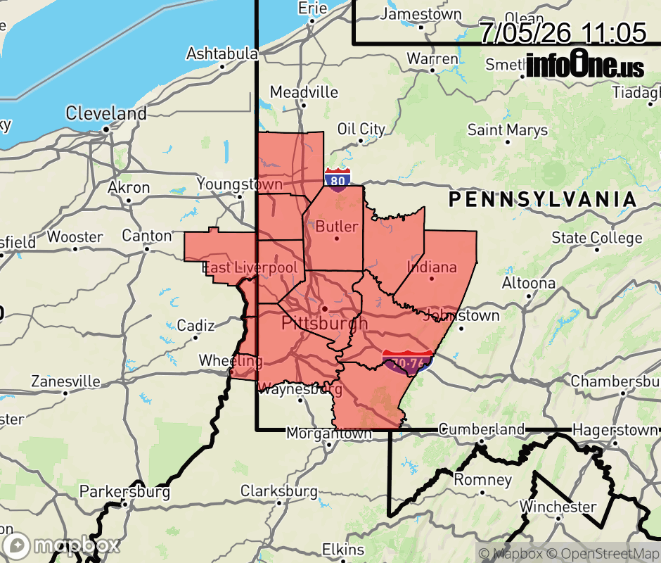 |
|||||||||
 Why aren't you using the InfoOne app? Why aren't you using the InfoOne app?
Stay abreast of information affecting your community! InfoOne tracks real-time information such as:
InfoOne currently supports over 100 communities in NC, VA and WV, and our coverage area is steadily growing. It's free! Install the InfoOne app today and see what you've been missing. |
Is this information important? Please share: Tweet | ||||||||