
|
Weather Alert |
| Scioto County, OH | |||||||||
|
|
||||||||
|
Canceled 8/11/26 11:15 AM Special Weather Statement issued August 11 at 10:46AM EDT by NWS Wilmington OH At 1046 AM EDT, a cluster of strong thunderstorms were located over Peebles, moving southeast at 70 mph. HAZARD...Wind gusts up to 45 mph, half inch hail, and very heavy rain. SOURCE...Radar indicated. IMPACT...Gusty winds could knock down tree limbs and blow around unsecured objects. Hail may cause minor damage to vegetation. Visibility will be poor and hydroplaning is possible. Locations impacted include... Portsmouth, Maysville, Hillsboro, Georgetown, Wheelersburg, Washington, Mount Orab, West Union, Bethel, Williamsburg, New Boston, Manchester, Peebles, Ripley, Aberdeen, Vanceburg, Augusta, Winchester, Marshall, and Sardinia. Motorists should slow down and use extra caution. A Severe Thunderstorm Watch remains in effect until 200 PM EDT for northern and northeastern Kentucky...and south central and southwestern Ohio. To report hazardous weather conditions, go to our website at weather.gov/iln and submit your report via social media, when you can do so safely. 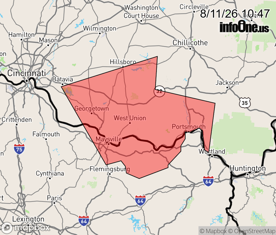 |
|||||||||
 Why aren't you using the InfoOne app? Why aren't you using the InfoOne app?
Stay abreast of information affecting your community! InfoOne tracks real-time information such as:
InfoOne currently supports over 100 communities in NC, VA and WV, and our coverage area is steadily growing. It's free! Install the InfoOne app today and see what you've been missing. |
|||||||||