|
|
Weather Alert |
| Clay County, WV | |||||||||
|
|
||||||||
|
Canceled 6/19/25 4:30 PM Special Weather Statement issued June 19 at 3:46PM EDT by NWS Charleston WV At 345 PM EDT, Doppler radar was tracking strong thunderstorms along a line extending from Clendenin to near Spurlockville. Movement was east at 35 mph. HAZARD...Wind gusts up to 50 mph and pea size hail. SOURCE...Radar indicated. IMPACT...Gusty winds could knock down tree limbs and blow around unsecured objects. Minor hail damage to vegetation is possible. Locations impacted include... Charleston, Madison, Clay, South Charleston, Montgomery, Chesapeake, Marmet, Belle, Clendenin, Cedar Grove, East Bank, Glasgow, Smithers, Gauley Bridge, Pratt, Pinch, Harts, Birch River, Burnwell, and Julian. This includes the following highways... Interstate 79 between mile markers 1 and 2, between mile markers 5 and 7, and between mile markers 13 and 17. Interstate 77 in West Virginia between mile markers 96 and 103. West Virginia Turnpike between mile markers 68 and 95. 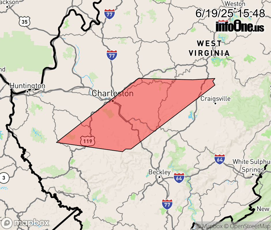 |
|||||||||
 Why aren't you using the InfoOne app? Why aren't you using the InfoOne app?
Stay abreast of information affecting your community! InfoOne tracks real-time information such as:
InfoOne currently supports over 100 communities in NC, VA and WV, and our coverage area is steadily growing. It's free! Install the InfoOne app today and see what you've been missing. |
|||||||||