
|
Weather Alert |
| Portage County, OH | |||||||||
|
|
||||||||
|
Canceled 7/5/26 10:00 PM Flood Watch issued July 5 at 5:44PM EDT until July 5 at 10:00PM EDT by NWS Cleveland OH * WHAT... Flash flooding caused by excessive rainfall continues to be possible. * WHERE... Portions of north central and northeast Ohio, including the following counties, in north central Ohio, Lorain. In northeast Ohio, Cuyahoga, Mahoning, Medina, Portage, Stark, Summit and Wayne. * WHEN... Until 10 PM EDT this evening. * IMPACTS... Excessive runoff may result in flooding of rivers, creeks, streams, and other low-lying and flood-prone locations. * ADDITIONAL DETAILS... - Showers and thunderstorms will slowly move across the area this evening. Peak rainfall rates of 2 to 3 inches per hour are expected with the strongest storms. - Please visit www.weather.gov/safety/flood for flood safety and preparedness information. 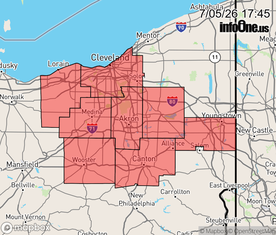 |
|||||||||
 Why aren't you using the InfoOne app? Why aren't you using the InfoOne app?
Stay abreast of information affecting your community! InfoOne tracks real-time information such as:
InfoOne currently supports over 100 communities in NC, VA and WV, and our coverage area is steadily growing. It's free! Install the InfoOne app today and see what you've been missing. |
|||||||||