|
|
Weather Alert |
| Taylor County, WV | |||||||||
|
|
||||||||
|
Canceled 10/21/25 7:47 PM Severe Thunderstorm Warning issued October 21 at 7:17PM EDT until October 21 at 8:00PM EDT by NWS Charleston WV SVRRLX The National Weather Service in Charleston West Virginia has issued a * Severe Thunderstorm Warning for... Southeastern Doddridge County in northern West Virginia... Southwestern Taylor County in northern West Virginia... Northern Lewis County in northern West Virginia... North central Upshur County in northeastern West Virginia... Northwestern Barbour County in northeastern West Virginia... Harrison County in northern West Virginia... * Until 800 PM EDT. * At 716 PM EDT, a severe thunderstorm was located 8 miles west of Jackson Mill, or 9 miles northwest of Weston, moving east at 40 mph. HAZARD...60 mph wind gusts and quarter size hail. SOURCE...Radar indicated. IMPACT...Hail damage to vehicles is expected. Expect wind damage to roofs, siding, and trees. * Locations impacted include... Clarksburg, Weston, Bridgeport, Stonewood, Nutter Fort, Anmoore, Jackson Mill, West Milford, Lost Creek, Jane Lew, Camden, Volga, Rosemont, Century, Avon, Wolf Summit, Alum Bridge, Hodgesville, Meadowbrook, and Despard. This includes the following highways... Interstate 79 between mile markers 95 and 126. Route 50 in West Virginia between mile markers 70 and 82. Route 33 near mile marker 1. 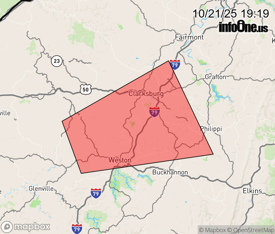 |
|||||||||
 Why aren't you using the InfoOne app? Why aren't you using the InfoOne app?
Stay abreast of information affecting your community! InfoOne tracks real-time information such as:
InfoOne currently supports over 100 communities in NC, VA and WV, and our coverage area is steadily growing. It's free! Install the InfoOne app today and see what you've been missing. |
|||||||||