|
|
Weather Alert |
| Athens County, OH | |||||||||
|
|
||||||||
|
Canceled 6/14/25 7:15 PM Special Weather Statement issued June 14 at 6:58PM EDT by NWS Charleston WV At 658 PM EDT, Doppler radar was tracking a cluster of strong thunderstorms near Nelsonville, moving northeast at 20 mph. HAZARD...Pea size hail. SOURCE...Radar indicated. IMPACT...Minor hail damage to vegetation is possible. Locations impacted include... Glouster, Shawnee, Nelsonville, Crooksville, New Straitsville, Corning, Buchtel, Jacksonville, Murray City, Trimble, Hemlock, Rendville, and Burr Oak State Park. 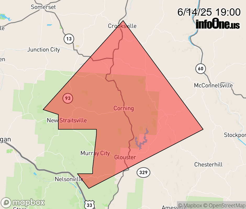 |
|||||||||
 Why aren't you using the InfoOne app? Why aren't you using the InfoOne app?
Stay abreast of information affecting your community! InfoOne tracks real-time information such as:
InfoOne currently supports over 100 communities in NC, VA and WV, and our coverage area is steadily growing. It's free! Install the InfoOne app today and see what you've been missing. |
|||||||||