|
|
Weather Alert |
| Moore County, NC | |||||||||
|
|
||||||||
|
Canceled 5/23/22 3:30 PM Tornado Warning issued May 23 at 2:59PM EDT until May 23 at 3:30PM EDT by NWS Raleigh NC At 259 PM EDT, a severe thunderstorm capable of producing a tornado was located near Carthage, moving northeast at 40 mph. HAZARD...Tornado. SOURCE...Radar indicated rotation. IMPACT...Flying debris will be dangerous to those caught without shelter. Mobile homes will be damaged or destroyed. Damage to roofs, windows, and vehicles will occur. Tree damage is likely. This dangerous storm will be near... Carthage around 305 PM EDT. Sanford and Goldston around 325 PM EDT. Other locations impacted by this tornadic thunderstorm include Cumnock, Harpers Crossroads, Highfalls, Robbins and Glendon. 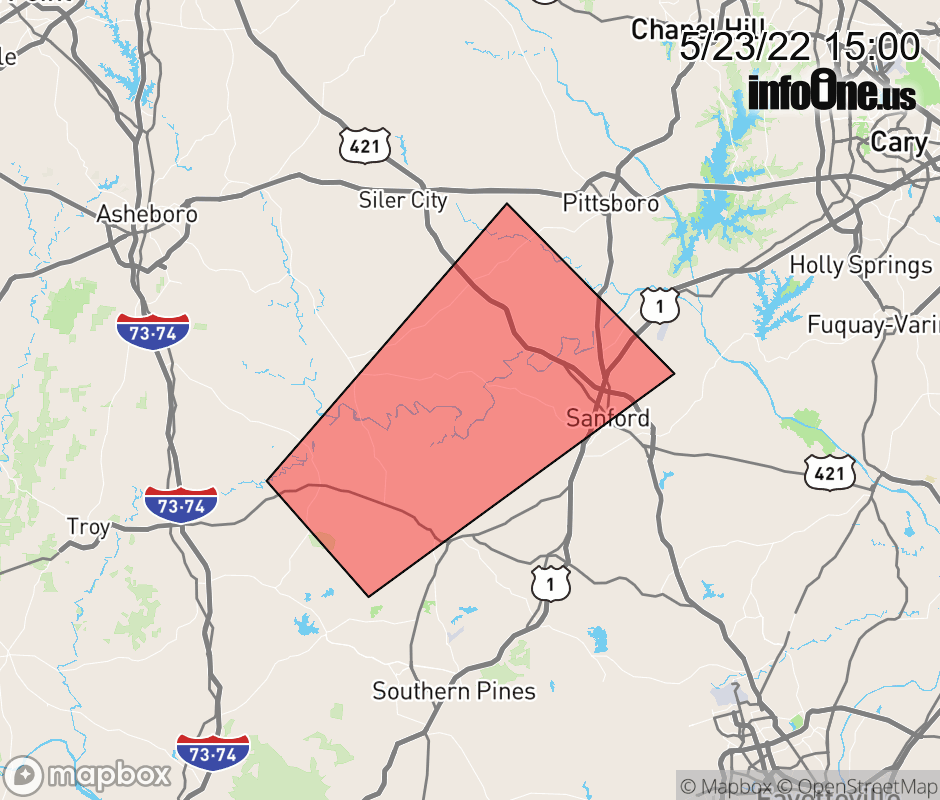 |
|||||||||
 Why aren't you using the InfoOne app? Why aren't you using the InfoOne app?
Stay abreast of information affecting your community! InfoOne tracks real-time information such as:
InfoOne currently supports over 100 communities in NC, VA and WV, and our coverage area is steadily growing. It's free! Install the InfoOne app today and see what you've been missing. |
|||||||||