|
|
Weather Alert |
| Boone County, WV | |||||||||
|
|
||||||||
|
Canceled 6/12/26 2:52 PM Severe Thunderstorm Warning issued June 12 at 2:28PM EDT until June 12 at 3:15PM EDT by NWS Charleston WV SVRRLX The National Weather Service in Charleston West Virginia has issued a * Severe Thunderstorm Warning for... Central Kanawha County in central West Virginia... East central Lincoln County in central West Virginia... Southwestern Clay County in north central West Virginia... Northwestern Fayette County in southeastern West Virginia... Northeastern Boone County in central West Virginia... * Until 315 PM EDT. * At 228 PM EDT, a severe thunderstorm was located 8 miles southwest of Marmet, or 9 miles northeast of Madison, moving southeast at 20 mph. HAZARD...60 mph wind gusts and quarter size hail. SOURCE...Radar indicated. IMPACT...Hail damage to vehicles is expected. Expect wind damage to roofs, siding, and trees. * Locations impacted include... Charleston, South Charleston, Montgomery, Chesapeake, Marmet, Belle, Cedar Grove, East Bank, Glasgow, Smithers, Pratt, Glen, Coal Fork, Julian, Alum Creek, Powellton, Handley, Seth, Dawes, and Ashford. This includes the following highways... Interstate 77 in West Virginia between mile markers 96 and 99. West Virginia Turnpike between mile markers 74 and 95. Route 119 between mile markers 57 and 73. 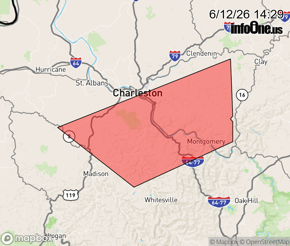 |
|||||||||
 Why aren't you using the InfoOne app? Why aren't you using the InfoOne app?
Stay abreast of information affecting your community! InfoOne tracks real-time information such as:
InfoOne currently supports over 100 communities in NC, VA and WV, and our coverage area is steadily growing. It's free! Install the InfoOne app today and see what you've been missing. |
|||||||||