|
|
Weather Alert |
| Belmont County, OH | |||||||||
|
|
||||||||
|
Canceled 5/31/25 2:57 AM Flood Warning issued May 30 at 9:07PM EDT until May 31 at 3:00AM EDT by NWS Pittsburgh PA * WHAT... Flooding caused by excessive rainfall is expected. * WHERE... Portions of east central Ohio, including the following counties, eastern Belmont and northeastern Monroe and West Virginia, including the following counties, Marshall, Ohio and northwestern Wetzel. * WHEN... Until 300 AM EDT. * IMPACTS... Flooding of rivers, creeks, streams, and other low-lying and flood-prone locations is imminent or occurring. Streams continue to rise due to excess runoff from earlier rainfall. * ADDITIONAL DETAILS... - At 903 PM EDT, Doppler radar indicated heavy rain was tapering off. Runoff from the heavy rain earlier today will still result in flooding is ongoing or expected to begin shortly in the warned area. Between 1 and 2 inches of rain have fallen. - Some locations that will experience flooding include... Wheeling, Moundsville, Martins Ferry, New Martinsville, St. Clairsville, Bellaire, Warwood, Bethlehem, Triadelphia, Clearview, Valley Grove, Shadyside, McMechen, Powhatan Point, Glen Dale, Cameron, Bridgeport, Benwood, Yorkville and Brookside. - http://www.weather.gov/safety/flood 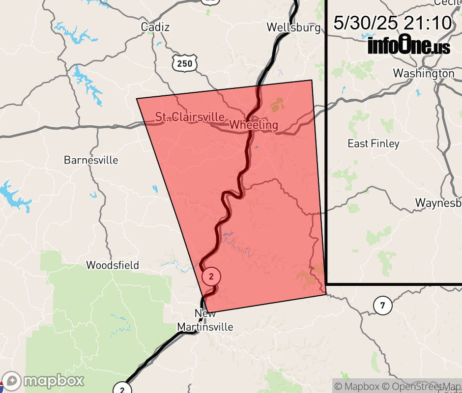 |
|||||||||
 Why aren't you using the InfoOne app? Why aren't you using the InfoOne app?
Stay abreast of information affecting your community! InfoOne tracks real-time information such as:
InfoOne currently supports over 100 communities in NC, VA and WV, and our coverage area is steadily growing. It's free! Install the InfoOne app today and see what you've been missing. |
|||||||||