|
|
Weather Alert |
| Tyler County, WV | |||||||||
|
|
||||||||
|
Canceled 6/15/25 5:54 PM Flash Flood Warning issued June 15 at 5:33PM EDT until June 15 at 6:30PM EDT by NWS Charleston WV At 533 PM EDT, Doppler radar indicated thunderstorms producing heavy rain across the warned area. Between 2 and 3 inches of rain have fallen. Additional rainfall amounts of 0.5 to 1.5 inches are possible in the warned area. Flash flooding is already occurring in the area of Route 23 N and Beverlin Fork. HAZARD...Flash flooding caused by thunderstorms. SOURCE...Radar. IMPACT...Flash flooding of small creeks and streams, urban areas, highways, streets and underpasses as well as other poor drainage and low-lying areas. Some locations that will experience flash flooding include... Salem, Center Point, Sedalia, Canton and Wallace. 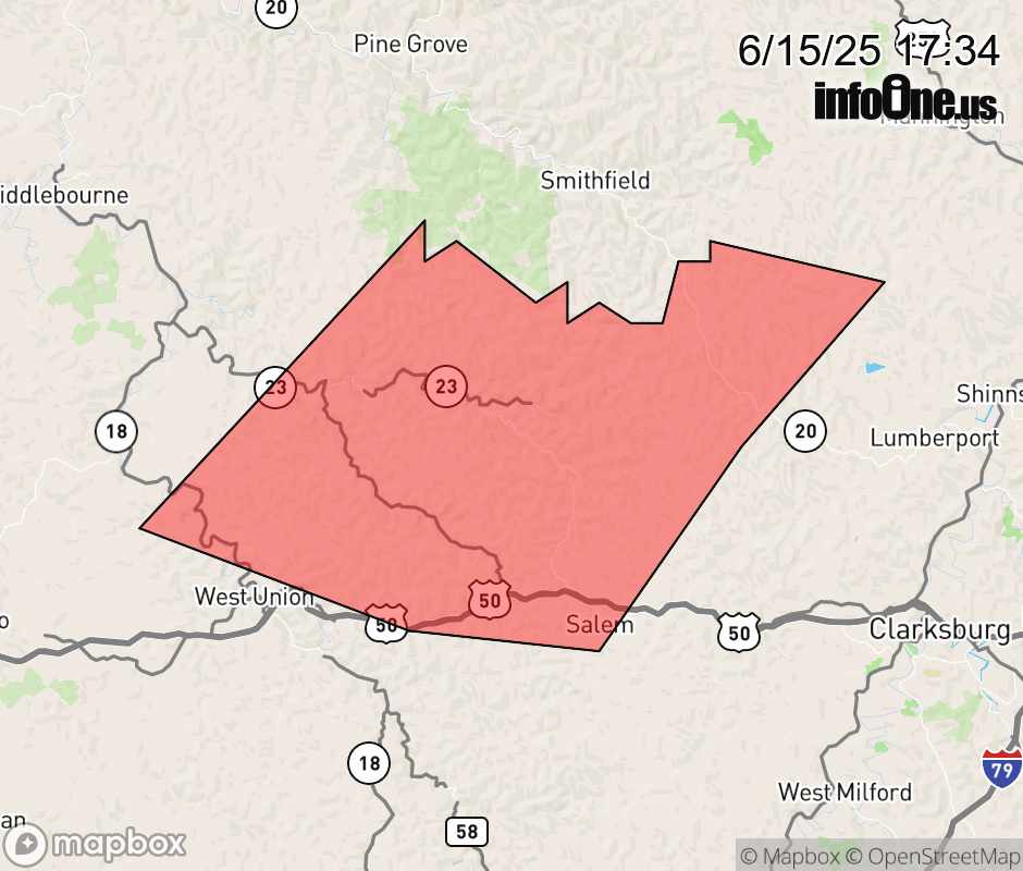 |
|||||||||
 Why aren't you using the InfoOne app? Why aren't you using the InfoOne app?
Stay abreast of information affecting your community! InfoOne tracks real-time information such as:
InfoOne currently supports over 100 communities in NC, VA and WV, and our coverage area is steadily growing. It's free! Install the InfoOne app today and see what you've been missing. |
|||||||||