|
|
Weather Alert |
| Stokes County, NC | |||||||||
|
|
||||||||
|
Canceled 7/26/21 3:00 PM Special Weather Statement issued July 26 at 2:10PM EDT by NWS Blacksburg VA At 210 PM EDT, a strong thunderstorm was located near Collinstown, or near Stuart, moving east at 15 mph. Winds in excess of 30 mph and pea size hail are possible with this storm. Locations impacted include... Sandy Ridge... Ararat... Collinstown... Prestonville... Penns Store... and Patrick Springs. Locally heavy rain will quickly reduce visibility and result in ponding of water on roadways, standing water in low lying areas, and minor flooding of creeks, streams, and areas of poor drainage. Drivers are urged to slow down and use extra caution to avoid hydroplaning. Frequent cloud to ground lightning is occurring with this storm. Lightning can strike 10 miles away from a thunderstorm. Seek a safe shelter inside a building or vehicle. This storm may intensify, so be certain to monitor local radio stations and available television stations for additional information and possible warnings from the National Weather Service. 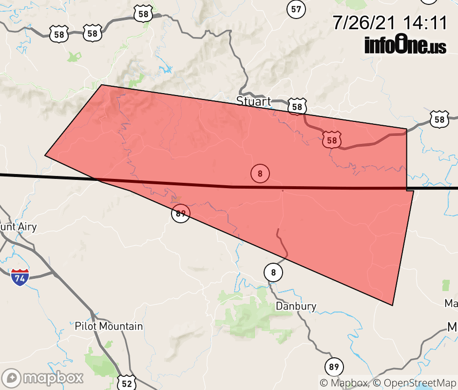 |
|||||||||
 Why aren't you using the InfoOne app? Why aren't you using the InfoOne app?
Stay abreast of information affecting your community! InfoOne tracks real-time information such as:
InfoOne currently supports over 100 communities in NC, VA and WV, and our coverage area is steadily growing. It's free! Install the InfoOne app today and see what you've been missing. |
|||||||||