|
|
Weather Alert |
| Wilkes County, NC | |||||||||
|
|
||||||||
|
Canceled 9/25/25 10:21 PM Flood Advisory issued September 25 at 8:10PM EDT until September 25 at 11:15PM EDT by NWS Blacksburg VA * WHAT... Flooding caused by excessive rainfall is expected. * WHERE... A portion of northwest North Carolina, including the following counties, Ashe, Watauga and Wilkes. * WHEN... Until 1115 PM EDT. * IMPACTS... Minor flooding in low-lying and poor drainage areas. Some low-water crossings may become impassable. Ponding of water in urban or other areas is occurring or is imminent. * ADDITIONAL DETAILS... - At 810 PM EDT, Doppler radar indicated heavy rain due to thunderstorms. Minor flooding is ongoing or expected to begin shortly in the advisory area. Between 1.5 and 2.5 inches of rain have fallen. - This includes the following streams and drainages... Little Peak Creek, Middle Fork Reddies River, Call Creek, Grassy Creek, Little Fork, Elk Creek, Darnell Creek, Mill Creek, Clear Branch, Fall Creek, Beaver Creek, Little Fork Creek, Dugger Creek, Meat Camp Creek, Church Branch, Flat Branch and Left Prong Stony Fork. Additional rainfall amounts up to 1 inch are expected over the area. This additional rain will result in minor flooding. - Some locations that will experience flooding include... Boone... Deep Gap... Glendale Springs... Wilbar... Mc Grady... Cascade Falls... Summit... - http://www.weather.gov/safety/flood 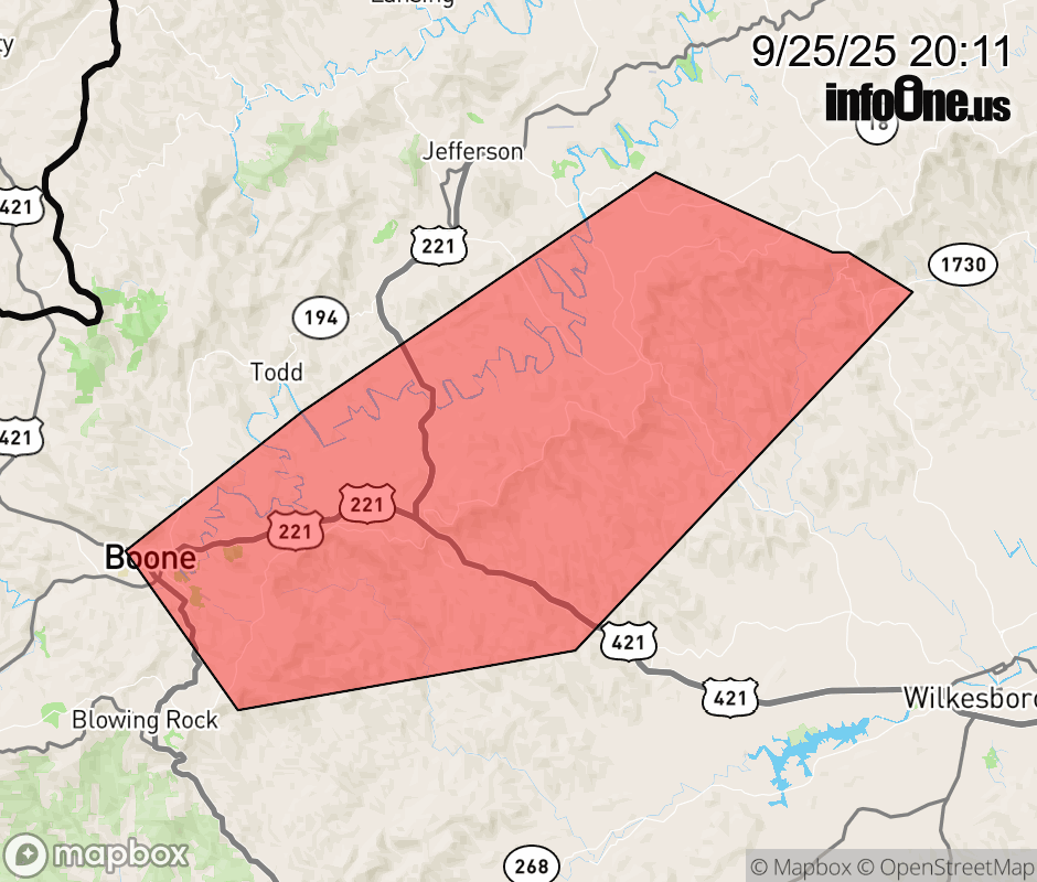 |
|||||||||
 Why aren't you using the InfoOne app? Why aren't you using the InfoOne app?
Stay abreast of information affecting your community! InfoOne tracks real-time information such as:
InfoOne currently supports over 100 communities in NC, VA and WV, and our coverage area is steadily growing. It's free! Install the InfoOne app today and see what you've been missing. |
|||||||||